Lower Crab Creek Overland Tour – 5.5.2007

Now that I have my eight year old daughter interested in photography, there is no way that she’ll miss an opportunity for a road trip with her dad. Before her new interest in photography, it was agony on even the shortest trip, the typical “are we there yet” or “when are we going to get there?” of an eight year old.
That has changed since my wife and I let our daughter have our recently retired Sony Cybershot DSC-S30 1.3 megapixel digital camera (yes, you heard it right, recently retired; replaced by a Canon Powershot A550 and a soon to arrive Nikon D80 SLR).

So, when I asked her, “do you want to go?”, it was an absolute, no question about it “yes”. It didn’t matter when I reaffirmed that we’d be gone all day and wouldn’t be home until late and that I had no specific destination in mind. I now have an overland adventure companion (in addition to the dog).
After a late getting out of the house (primarily because of my indecision of where to go) we headed out toward Eastern Washington. My goal was the Lower Crab Creek Road, and who knows from there.

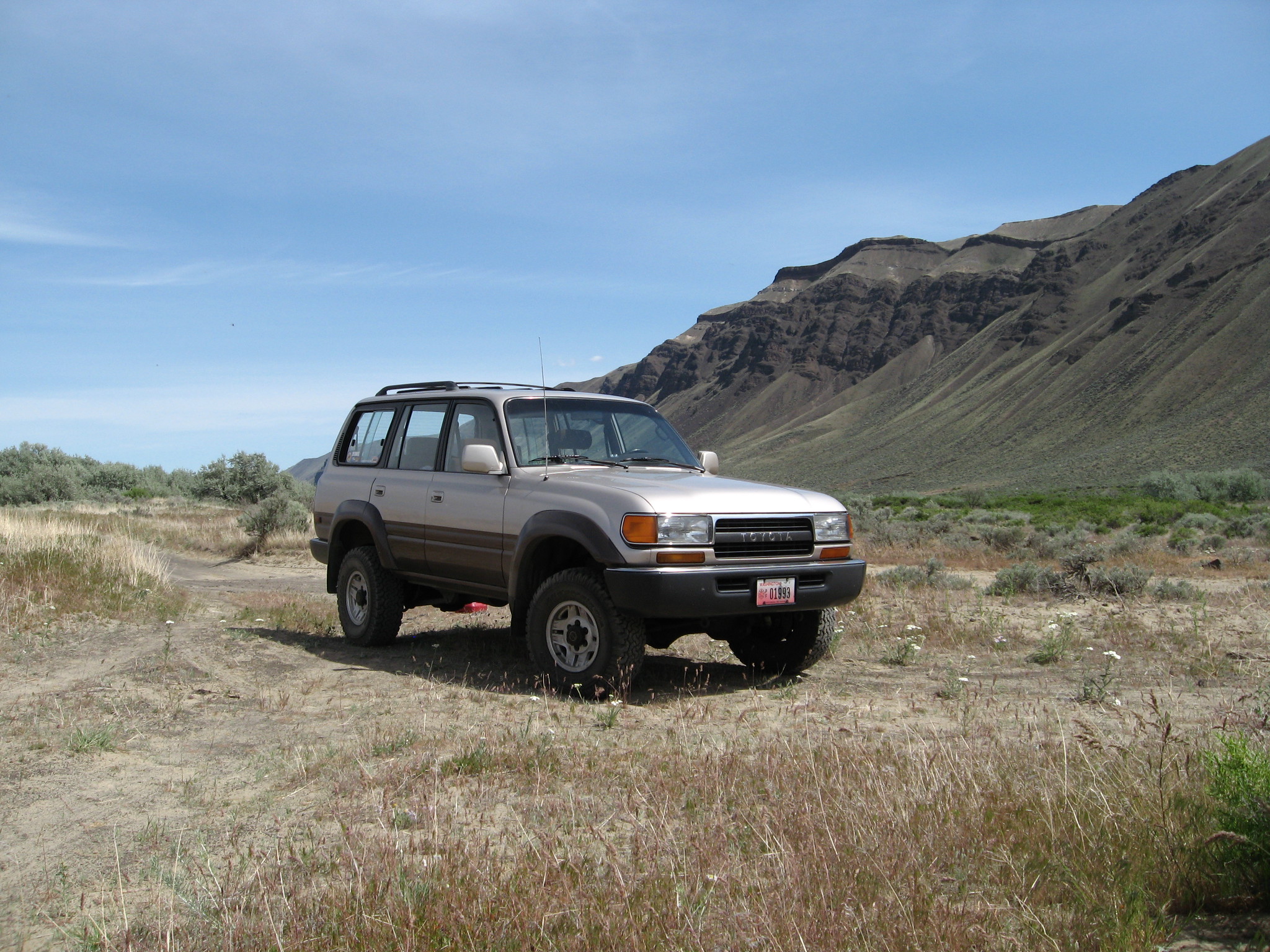
After crossing the Columbia River at Vantage, Washington, we made a quick stop along Highway 243 just South of I-90 to take a quick photo of the Vantage Bridge. Our next stop was a little further down the highway, where I noticed a dirt road headed toward the river. I took a chance, and sure enough, it led us down a steep dirt road to the river’s edge. A nice private location to take a break, let the dog run, and take a few photos. This little side trip was as close to four wheeling as we got all day.
Our next stop was at the Wanapum Dam on the Columbia River. Unlike a previous trip to the Wanapum Dam, we were on the side where the Wanapum Heritage Center and Museum were located.

The museum chronicles the history of the immediate area, starting with the Native American tribes of the region, the initial prospectors, then the settlers and finally the building of the Wanapum Dam. There are very nice displays of artifacts from all the eras mentioned, including a dug out canoe.
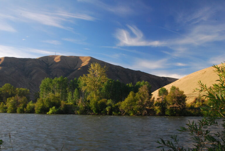
A few miles South of the Wanapum Dam is the Lower Crab Creek Road, the only planned destination for the day. Crab Creek is one of a few perennial streams in the Columbia Basin, flowing from the northeastern Columbia River Plateau, west of Spokane, Washington, west-southwest to empty into the Columbia River near the community of Beverly, Washington (where the Lower Crab Creek Road begins).

Lower Crab Creek Roads starts by going through the community of Beverly. In about 3 miles, the pavement ends and turns to gravel. We passed the Beverly Dunes ORV park on the South side of the road. This is where we entered the Crab Creek Wildlife Area.
The Lower Crab Creek Road is flanked by the Saddle Mountains on the South and the abandoned Chicago Milwaukee St. Paul and Pacific rail line (the name as per the Washington Atlas) on the North.
We stopped for lunch, where the road crosses Lower Crab Creek and the location of some dried up seasonal ponds. With limited time, we didn’t get a chance to explore the area, but it looks like it would be a great place for some fishing.

I imagine during the morning and evening hours, wildlife be quite abundant (hence the wildlife area). My daughter got excited when we had a coyote run across the road in front of us, the first she saw outside of the zoo. Other animals we spotted in this area include multiple ground squirrels and even a muskrat swimming in the creek.
This stretch of Lower Crab Creek Road was probably the smoothest gravel road I drove. I don’t know if it stays that way throughout the year, but this day was nice.

After about 10 miles of gravel road, the road turns to pavement. After about 3 miles of pavement, the paved road veers to the left (north) and turns into E Rd SW. There is a three way junction of the rail line with an old trestle at this location also. We stayed to the right to continue on Lower Crab Creek Road, which again turned to gravel. An old shed and other related debris from the rail road are located here.
This section of the road is not as well maintained as the earlier section. After about three miles, the road climbs out of the valley a short distance through an outcropping of rocks onto a plateau with free range cattle hanging out along the road.
After 10 miles of gravel road, the Lower Crab Creek Road brought us back to Highway 26, just West of Othello, Washington.
With a real meal on my daughter’s mind (more like ice cream), we headed to Othello. After fueling up, and a quick bite at local fast food, we made a small tour of the business district of Othello, including a stop at the city park with a Lockheed T-33 Shooting Star jet trainer on display.

From downtown Othello, we headed north on N. Broadway Rd. following the railroad tracks out of town. Once out of Othello, the road turns into W. McManamon Road. After approximately 10 miles from downtown Othello, we took a right (North) on S. Morgan Lake Rd. There is also a sign marking this road as the Columbia National Wildlife Refuge.
After about two miles and passing numerous lakes, the road again turns to gravel, where it again meets up with Lower Crab Creek. Needing another break from being on the road (the key to traveling with an eight year old), we stopped at the Frog Lake Trailhead and walked around the nature trails for a little while.

By this time, it was already after 6:00 PM, so we headed North following Lower Crab Creek. We made short side trips from the main road, including Upper Goose Lake and Soda Lake. A person could spend weeks visiting the multitude of lakes in this area, many requiring a short hike. I know fishing is usually pretty good too.
Eventually, the road led us back to Highway 262 at the O’Sullivan Dam at the Potholes Reservoir and the end of our back road tour of Lower Crab Creek. From the dam, it was time to head West for a three hour drive and a late arrival home.
Had I planned better, I would have prepared to spend the night somewhere along the way, preferably camping, but since the night temperatures are still in the 30s, a motel would have been fine, too (for my daughter’s sake).

Crab Creek continues from Moses Lake in a Northwestern direction to about 20 miles west of Spokane, Washington. To continue following the creek would require a little more route finding, a little backtracking, and probably a four wheel drive for some areas. Most likely, there are areas that are inaccessible by vehicle. I’ll have to save that trip for another day.
You can view the photos taken on this trip at Lower Crab Creek Tour.