Cascade Overland Adventure – August 2006

With an actual weekend off, and knowing that I would probably soon be selling my Jeep Wrangler to buy a larger adventure vehicle, it was time for a three-day Jeep adventure.
Our first goal (my son Steven and myself) was to travel from I-90 near Cle Elum, Washington, to Highway 410 near Cliffdell, Washington, via logging roads. I heard people talk about such a road in the past, but have never attempted to locate it.
Our second goal was to travel from Highway 410 to Highway 12 over logging roads. We would then travel Highway 12 over White Pass to Packwood. From Packwood, we would head South on logging roads towards Mt. Adams and locate a campsite for the night.
As in previous adventures, I turned to the book Washington Byways: Backcountry Drives For The Whole Family by Tony Huegel for some of my planning. The most likely route was to use Tour 43 – Quartz Mountain as a starting point for our weekend adventure.
Day One: Snoqualmie Pass to Little Naches River

After getting our Jeeps loaded for a three-day adventure, we headed East over Snoqualmie Pass to Cle Elum. After a quick fast food lunch and fuel, we headed to the Wenatchee National Forest Information Center to purchase a forest service map of the area. These maps have been hard to come by on the west side of the cascades, so I made the purchase, plus a few other National Forest maps in Washington state. They were three dollars cheaper than in the local sporting goods retailers.
After obtaining the map, it was time for route finding from Cle Elum over Manastash Ridge to Highway 410. Unfortunately, we could not locate a gravel road that wasn’t on private property that did not require extensive backtracking to Ellensburg to reach our goal. Because of the time of the day, we noted some designated four-wheel drive trails that would link us to our destination.

Our plan was to have waypoints and actual mileage points for this article. However, my son’s GPS unit would not cooperate, so we had a good lesson in route finding via a forest service map and compass.
If you were to use Washington Byways Tour 43 – Quartz Mountain as your guide, you would start at the end of the tour as outlined in the book. To add some detail, you will get off at any Cle Elum exit from I-90 and find First Street (the main road through town). From First Street, head south on Stafford Ave (one of only a few traffic lights) to South Cle Elum. Take a right on Madison Ave, then a left on 6th St, and then a right on Marie Ave. Marie Ave turns into Westside Dr. once you leave town. You’re looking for South Cle Elum Ridge road (FS Rd 4510), which will be on your left. This is where I zeroed my odometer (Caution: the distances stated are only approximate, my Jeep odometer runs fast and shows more miles than traveled).

We switched back up out of the valley on a single-lane gravel road with occasional views to the valley below and the mountains to the north. At about 7 miles, there will be a junction with FS 119. Follow it to the right toward Taneum Campground.
At 12 miles, we passed a junction with FS 33, where it turns to pavement (and a school bus turn around). Travel a short distance and take a right on FS 3330 toward Quartz Mountain.
At 23 miles, follow FS 3120 toward Buck Meadows, then shortly thereafter take a left on FS 109, then a right on FS 3111.

At 32 miles, take a left on FS 31 toward Ellensburg, then a right on FS3104.
At approximately 34 miles, we reached
At approximately 39 miles, we reached an area called Tripod Flats. There are large open meadows where it seems many people end up camping. From here, there were multiple directions we could travel. To continue further, with the exception of the trail we chose, a short wheelbase 4×4 with lockers and a solid roll cage would be recommended.

We headed left down Trail 687, then onto Trail 686, then to Trail 685 (all rated as “more difficult,” probably a Trail Rating of +4.0 for SWB vehicles). A shorter trail but more challenging then the first trail we traveled.
We came out on FS 589, leading us to FS 1708 (Milk Creek Road) and down Highway 410 at 51 miles.
After a very dusty 50 miles, we decided to camp at the Crow Creek Campground off the Little Naches River. We set up camp, had a quick washdown in the creek, ate dinner, and settled in for the night. Surprisingly, not many people for a Friday night.
Day Two: Little Naches to Cispus River

After a very restful night on my new inflatable camping mattress, I awoke to something dropping on and around my tent. Upon investigation, I found a squirrel in the tree above my tent chewing off pinecones and sending them down upon my tent. These weren’t ordinary pinecones, they were solid and heavy. When the pinecones hit the ground, they bounced up several feet in the air. One even bounced onto the picnic table to hit my cook set.
After a while, I realized that this bombardment with pinecones seemed intentional. The squirrel was at work only over my tent and the picnic table. It was a large tree, so there were other areas where the pinecones could have dropped, but that wasn’t the case. Either it was a territorial instinct, or the squirrel did not like the presence of my dog.

Once I began breaking down my tent, the rain of pinecones intensified. After each drop, I could hear the squirrel chattering, almost laughing each time a pinecone was dropped. After I pulled the stakes on my tent, I picked up the tent and moved to a safer area. Once the tent was removed, the pinecones stopped falling.
Once everything was packed up, it was time for the day’s adventure. Our goal for the day was to travel from Highway 410 to Highway 12 via logging roads, then over White Pass by highway to Packwood, Washington. Then from Packwood, we would head south via logging roads to the Mt. Adams area and locate a campsite for the night.

As in the previous day’s adventure, we chose another route outlined in the book, Washington Byways. On this day, we again started the reverse route outlined in the book. The route we chose is listed in Washington Byways as Tour 47 – Bethel Ridge.
From our campsite at Crow Creek, we traveled back to Highway 410 and headed East toward Yakima. We turned right at the first sign for Nile Road. The Nile Road parallels SR 410 and loops back to the highway. We took the longer scenic route to get to our turnoff.
From our direction of travel, we turned right on Forest Service Rd. 1500 (follow signs to Highway 12). FS 1500 starts out as a single-lane, paved road with turnouts. The road climbs up and travels through the Rattlesnake Creek canyon. There are some great views of the surrounding peaks and the canyon below.

After about 8 miles, the pavement ends, and the road transitions to gravel. FS 1500 continues through the forest, eventually ending up on Bethel Ridge. At about 17 miles (only an approximation because of my odometer) is the turnoff for Timberwolf Mountain FS 1500-90). This excursion is worth the side trip for the extensive views on a clear day. Along the way, the road climbs, passing open meadows and an old cabin. The road ends in about 3 miles.

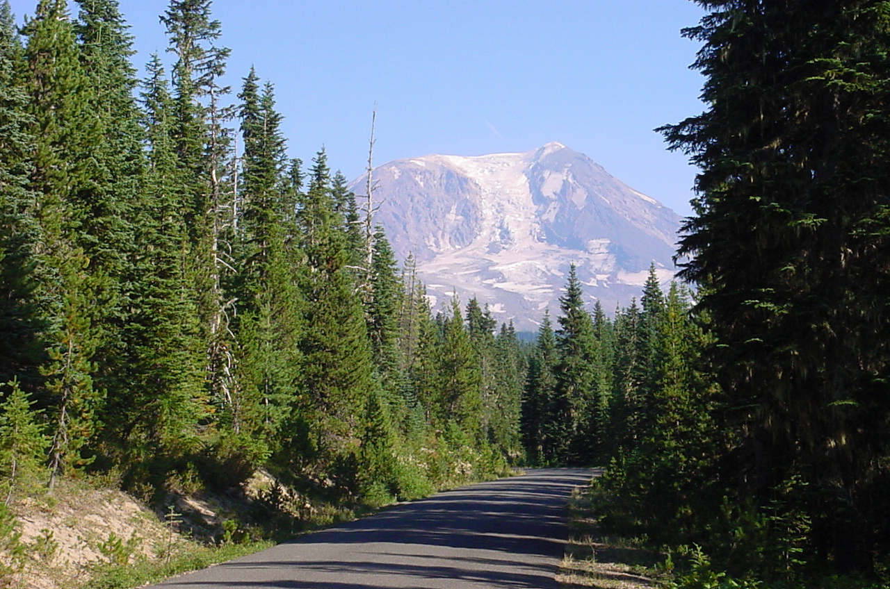
At the roads end is the site of an old forest fire lookout. Nothing remains of the original fire lookout structure. The 360-degree views are fantastic, including Mt. Rainier, Mt. Adams, Goat Rocks, the Cascades, and even views into high desert of Eastern Washington. If you need to check in with the family, there is excellent cellular phone reception on the peak.

After lunch and photographs, we headed back down to FS 1500. If a person had more time and wanted to explore, many side roads travel miles from FS 1500. From the Timberwolf Mountain road, the FS 1500 switchbacks down into the Tieton River valley to Highway 12. Along the way are views of the valley and Rimrock Lake below. At approximately 34 miles, we arrived on Highway 12.

If one wanted to continue the backroads journey east, one could take FS 1200 around the south side of Rimrock Lake, which will lead back to Highway 12. Since we had +30 miles of dust in an open Jeep, we opted to travel on Highway 12. The pavement was a welcomed change.
We traveled over scenic White Pass down into Packwood in approximately 40 miles. After a fuel stop, lunch, and a quick stop in the grocery store, we headed east a short distance to FS 21 (follow signs to Walupt Lake). Our next destination was to locate a campsite for the night.

FS 21 starts out steadily climbing through the forest, following the Johnson Creek canyon. In about 18 miles, we reached the junction with FS 2160, a paved road leading to Walupt Lake (a popular destination for camping). We headed east on FS 2160 for about two miles, then a right on FS 21 to head a little further south and get away from the crowds.
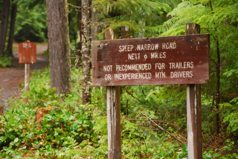
A short distance later, we took a right on FS 2329. Since FS 2329 was marked as not maintained, we assumed that there would be very little traffic. We were wrong, of course. We encountered many vehicles, including trailers, on the narrow, winding gravel road.

After a few miles of traveling on FS 2329, we came to a junction with a wide, well maintained road that leads to the Yakima Indian Reservation only a few miles from the junction. This vast area, much of it wilderness, is closed to the public.
FS 2329 eventually becomes the western border of the Mt. Adams Wilderness area. This easy access makes it a popular starting point for hikes into the wilderness area.
Our desire for a campsite in a designated campground (to have a legal campfire) was soon spoiled. Every high country campground we stopped at, including Horseshoe Lake, Killen Creek, Takhlakh Lake, Chain of Lakes, and Olallie Lake, was full. Our only choice was to head to the lowlands and hopefully find a primitive site along a creek or river to camp.

We followed FS 23 until it intersected with FS 2801. FS 2801 follows the Cispus River on its south side. Unfortunately, most of it was high bank, so there was minimal river access. Every campsite we found that was near any water was already claimed.
Our quest for a campsite continued until nearly dark when we finally located an isolated campsite, only yards from the Cispus River, just upstream from Tower Rock.

Once we arrived, it was time for an ice cold beer while setting up camp. Obsidian Stout was the selection of the evening. After cleaning up a bit and eating a gourmet dinner of hot dogs, it was time to kick back and relax (my dog decided to relax early on). Since our campsite was on the bank of the river, we had a beautiful scenic setting to sit and enjoy. Just before dusk, the trout in the river had a feeding frenzy on all the insects buzzing the river’s surface. I wish I had brought along a rod and reel.
After the sunset, the stars were out in full glory, with the Milky Way nearly direct over us. With no city lights, satellites and shooting stars were easy to spot. Eventually, we heard some splashing in the river near our camp. Upon further investigation (with a spotlight), we found a large salmon resting in the water near the river bank. The spotlight would spook the fish, but it would soon return to the bank. We also found a large frog on the river bank feeding on insects on the sand. Like the fish, the light would scare the frog, but in a few minutes, it returned to continue feeding.
We couldn’t have found a better campsite to spend the night. Good things come to those who wait.
Day Three: Cispus River to Mt. St. Helens

After another restful night, we awoke to another beautiful sunny morning in the northwest. When camping, first thing in the morning, I like to take a morning walk with the dog. On this day, I walked my dog downstream a short distance and got photographs of Tower Rock. Very quiet and peaceful.
After breakfast and packing up camp, we decided upon the day’s journey. We were now in country that I was very familiar with. I spent many hunting seasons learning about life in elk camp. This was the area where my dad would annually go elk hunting for the entire season, in addition to multiple trips throughout the year, deer hunting and camping.
Even I didn’t need a guidebook for this area, the next leg of our overland adventure is outlined as Tour 50 – French Butte in the book Washington Byways.
From our campsite, we headed west on FS 2801, a very short distance, until it met a junction with FS 28. We turned left on FS 28 and almost an immediate right on FS 76, which continues to follow the Cispus River downstream on its south bank.

After a short distance, there is another junction with FS 77, where we turned left up the hill (the only direction). This road is marked as Burley Mountain. From here, you start to switch back out of the Cispus River valley on a nice winding paved road, passing numerous waterfalls along the way. Eventually, the road turns to gravel.

At about 17 miles, there will be a junction. To the right is FS 77 (which we will follow later). To the left is FS 7605. We traveled left on FS 7605, and in less than two miles a spur road to the right (086) that leads to Burley Mountain. Travel about 0.5 miles and there will be a parking area. Many people park here and hike up to the lookout. The gate was open this day, so we continued up the steep, narrow road to the lookout. If you meet another vehicle, somebody will need to back up a short distance because there is no turnaround. Fortunately, the pickup truck we met only had to back up a short distance to a switchback wide enough for us to pass. About a quarter mile from the first parking area, we parked just below the summit of the lookout (plenty of room for two short wheelbase vehicles to turn around). You can drive to the summit, but there is only room for one, maybe two vehicles.
Burley Mountain is one of the few forest fire lookouts with the original building still standing. The door is unlocked, so you can even go inside the building. It’s a wonder that it hasn’t been vandalized or, even worse yet, burned down. The views of the southern Cascades don’t get any better than this. From this 5300-foot peak, you’re standing almost in the middle of four snow capped volcanoes. You look in one direction, there is Mt. Rainier. A slight turn is Mt. St. Helens. In another direction there is Mt. Adams. To the south is Mt. Hood in Oregon.

After lunch and photos (where I ran out of space on my memory card and deleted some shots), we headed back down the mountain to FS 77. Soon after reaching FS 77, we reached a four way junction and headed straight through (the roads were not very well marked the day we drove them) to continue on FS 77. The road begins to climb on a narrow pumis, dirt, and gravel non-maintained track.
We soon reached open meadows with additional views of Mt. Rainer, Mt. Adams, and Mt. St. Helens. In August, the huckleberries in this area are ripe. As in years past, many Native American groups camped out in the area picking the delicious berries. As the road zig zags followed the ridgeline, we passed French Butte and just below Pinto Rock.

A short distance past Pinto Rock, we came to the junction with FS 28. We took a right (west) that led us to FS 25 (a nice paved forest road) in about 3 miles.
Since we were in the area, we decided to make the trip to the Windy Ridge viewpoint of Mt. St. Helens. We took a right (north) on FS 25 for a few miles until we reached FS 99, which is clearly marked for all visitors.
FS 99 is a nice paved road designed to handle visitor traffic to the Windy Ridge visitor center overlooking Spirit Lake. There are multiple vista points of Mt. St. Helens and of the devastation of the 1980 eruption. At the end of the road, you reach the visitor center. At the visitor center, one can take in the view directly into the crater of the mountain, and then take a hike on one of the many trails in the area. A forest pass is required if parked at any of the designated trailheads. Since I had the dog (not allowed on the trails) and no way of locking our gear in an open top Jeep, we enjoyed the views and took photos before setting off.

A few miles from the Visitor Center, there is a parking area and a nature trail system for Meta Lake. Immediately past the parking area is FS 26 which leads to Ryan Lake, then onto FS 25 to Randle, Washington. This road used to be part of a loop that the forest service developed to keep traffic flowing in primarily one direction. Apparently, that idea has been abandoned because there are no signs on the north end directing travelers to Mt. St. Helens and none from FS 99 directing visitors back to Randle. We soon found out the reason why.

FS 26 is marked as a non-maintained road. This probably scares many tourists to the visitor center away (plus there are no signs that state where the road leads). The road was actually in decent shape. There were multiple areas where the road was repaired, intermixed with short sections of gravel. There are also many spots where the pavement has sunk down, but nothing that would prevent a careful driver of a standard car from driving it.
FS 26 starts out by dropping into the Green River drainage on the western flank of Strawberry Mountain, initially in the area affected by Mt. St. Helens, and then into various stages of growth from past clear cuts. Once past Ryan Lake, the road follows the Quartz Creek drainage most of the way back to FS 25. Once we were back at FS 25, it was only a short distance to Highway 12 and the end of our overland journey.
Final Words
In three days, we traveled around 500 miles, much of it on dry, dusty logging roads. In our journey, we visited two fire lookout sites, traveled over multiple passes, and flanked the borders of the three major volcanoes in the Southern Washington Cascades and several wilderness areas. The weather was perfect for camping and traveling in an open top Jeep.
Once we were home, I could practically take a measurement of the layer of dust in my Jeep. It would take me several days to clean my gear and dust out of my Jeep. Well worth the effort for the adventure we had. I can’t wait for the next adventure.
My photo gallery of the trip is located at http://www.flickr.com/photos/locked4low/.
My son’s photo gallery of the trip can be found at http://www.flickr.com/photos/smbisig/.