Deception Pass to Cape Flattery, Washington – Sept. 8-9, 2007

Initially, the family was only going to make a day trip to Oak Harbor, Washington, to visit friends for the day. However, since the forecast was for nice weather over the weekend, I suggested that we stay overnight in a hotel, take the Keystone-Port Townsend ferry over to the Olympic Peninsula the next morning, and do some sightseeing. I suggested Cape Flattery as one possible destination.
Saturday morning, we made it out the door and headed North on I-5. The closer we got to Seattle, you could easily tell that there was a University of Washington Huskies football game in town by the school colors on nearly 1 out of 5 vehicles on the freeway.

Once we reached Burlington, Washington, we headed west on Highway 20. Along the way, Padilla Bay and Fidalgo Bay views are visible from the highway. It was low tide when we passed, so the mud flats were visible.
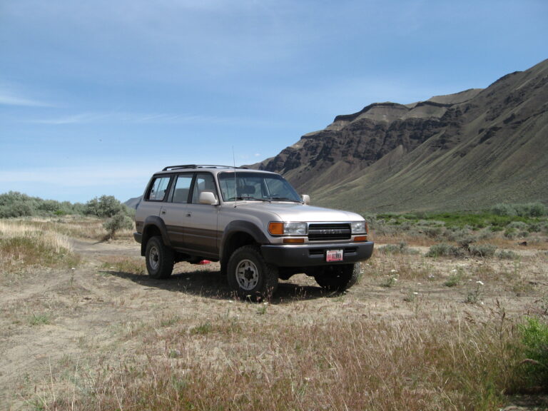
Our first stop along the way was at the Deception Pass bridge. After a few pictures and a quick peek at the water below, my wife elected to stay with the Toyota FJ80 Land Cruiser. At the same time, my daughter and I ventured out across the bridge for better photo opportunities.
In addition to the normal traffic over the bridge, there was an organized bike tour on Whidbey Island, which meant much more congestion.

To experience the views from the Deception Pass bridge, one must stop, get out of the car, and walk. You miss so much by simply driving across. The views are fantastic. We were even able to spot a seal in the water below.
Once back to the car, we headed into Oak Harbor for lunch and then to our friend’s house just outside of town. After a short visit, we headed to North Beach at Deception Pass State Park.
After some photos of the kids playing on the beach, I headed out with the camera and tripod for additional photos of the shoreline. I ended up walking the shoreline from the beach, around the point to the beach just below the Deception Pass Bridge. Great photo opportunities all around. I could have easily spent hours taking photos of the diverse shoreline.

After spending a few hours at the park, it was time for dinner and then back to the motel so the kids could swim in the pool.
The next morning, we headed out to catch the 8:45 Keystone – Port Townsend ferry. I forgot to set the alarm, so we had to rush a little. Luckily we made it with about ten minutes to spare, and the ferry wasn’t full.
We were fortunate that the weather was sunny and the water was relatively calm, though cool. This ferry ride was the first for my wife and daughter. After about a 30-minute ferry ride, we arrived in Port Townsend, Washington.

Once in Port Townsend, we parked the Land Cruiser and searched for a coffee shop downtown. After a coffee and a quick bite to eat, we strolled through the downtown area before heading out. Because of the time of day on a Sunday, most of the downtown businesses were closed.
From Port Townsend, we headed south on Highway 20 to US 101. Along the way, we had great views of Discovery Bay. Once on US 101, we headed west through Sequim and Port Angeles. We stopped in Port Angeles for fuel and lunch.
After lunch, we continued west on US 101 until we reached Lake Crescent in the Olympic National Park. US 101 follows the south shore of Lake Crescent and offers great views of the lake. Of course, we stopped along the way to take photos.

From Lake Crescent, we continued on US 101 through the Sol Duc River Valley. I pointed out the Kloshe Nanitch Lookout high above the valley floor.
When we reached Highway 113, we headed north towards the Straight of Juan de Fuca, where the road intersects SR 112, where we headed west. From this junction, SR 112 also leads east just outside Port Angeles. Once we reach Clallam Bay and Sekiu, SR 112 follows the shoreline of the Straight of Juan de Fuca. This stretch of highway is another must do scenic drive.

At the entrance of the Makah Indian Reservation, there was a tribal police checkpoint that was inquiring about our destination. Later we found out that some members of the Makah nation killed a whale the day before (that explains the TV news vans we saw later in the day). We made our way through Neah Bay, Washington, and followed the sign to Cape Flattery.
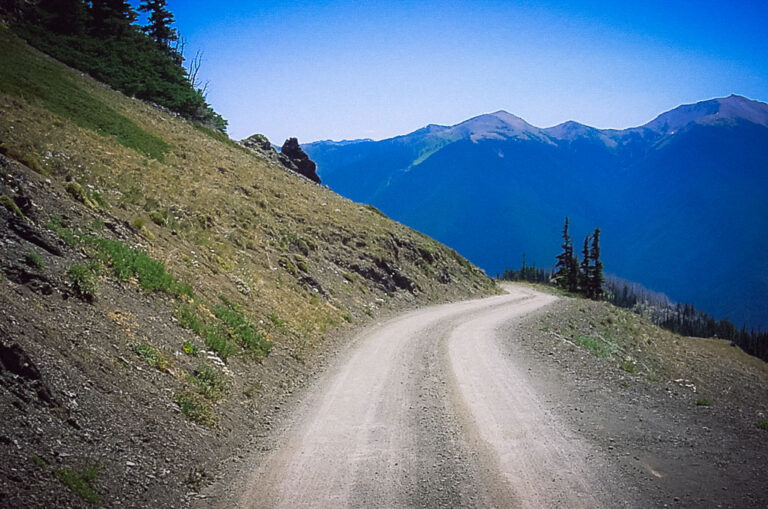
The road to Cape Flattery was in the process of getting paved. All except the last three miles was fresh pavement. The gravel sections were in excellent condition and will soon receive asphalt.
From the trailhead parking area, it’s about a 3/4 mile hike down to Cape Flattery. The trail is an easy hike through the forest, with many sections on wooden boardwalks over the more damp areas.
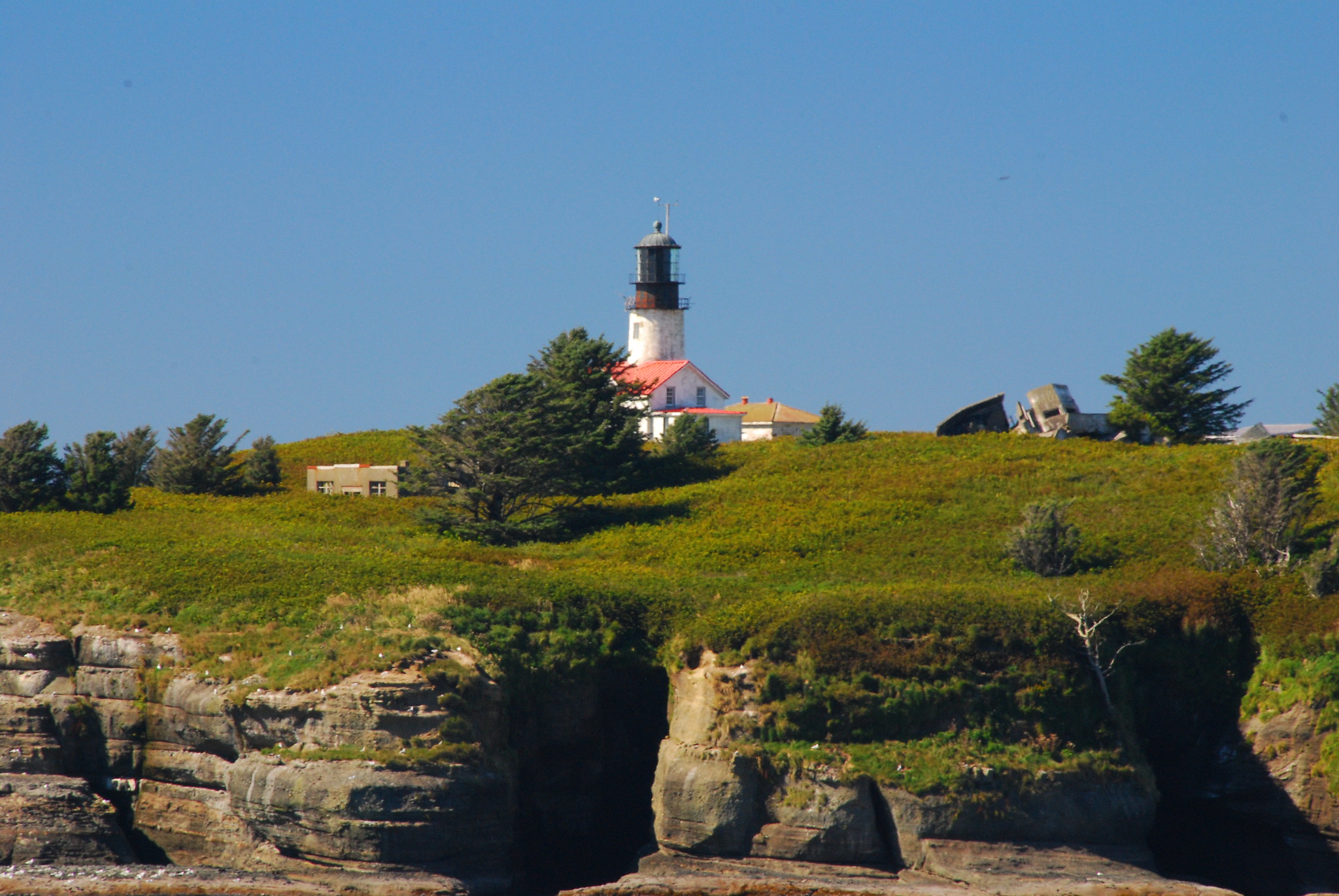
Once you reach Cape Flattery, there are great views of the Pacific Ocean, the Straight of Juan de Fuca, Vancouver Island, and the Cape Flattery Lighthouse on Tatoosh Island. Again, we had great weather.

By the time we completed the hike down to Cape Flattery, it was already mid-afternoon, which didn’t leave much time to do more sightseeing, so we had to start heading home.
The Olympic Peninsula has a diverse ecosystem, including ocean shorelines, river valleys, lakes, and rain forests to the alpine areas of the Olympic Mountains. There is so much to see on the Olympic Peninsula that it would probably take a good week to visit all the places you can visit by car. I guess another trip will have to be planned to explore more.
You can view all of the photos of this trip at Deception Pass to Cape Flattery Photos.