Trip Report: Washington Cascades Overland Tour 2007 – Day One (08.10.07)

Day One: August 10, 2007.
Daily Goal: To Drive from Carson, Washington (Highway 14 off the Columbia River near the Oregon border) to Packwood, Washington (Highway 12).

Today was going to be a very long day. Not only would I be attempting to reach my destination in Packwood, but I would also have to include the drive from my home in the middle of Washington state to the southern border near Oregon to start the tour of the Washington Cascade Mountains. My goal was to complete the drive from the Oregon border to British Columbia in four days (see Washington Cascades Overland Tour 2007 for the introduction to this adventure).
After four hours of driving I-5 and Highway 14, I reached Carson, Washington – the designated starting point of my Cascade Overland Tour. From Carson, I headed north on the Wind River Rd. to Bear Creek Rd. (FS-6808) and ascended to Triangle Pass. From Triangle Pass, I followed FS-68 down to FS-66 and headed north.

FS-66 follows the east side of the Big Lava Bed for about 10 miles. Big Lava Bed is a 10 mile long lava flow from about +8000 years ago. There are no roads into the flow, only around the perimeter. From FS-66, you can see the exposed lava flow through the sparse forest.
At the end of the Big Lava Bed, I reached South Prairie. You see meadows and a small seasonal lake.
From South Prairie, I followed FS-6615 to FS-6621 to FS-60, which led to Goose Lake and what looked like a nice campground. A few people were fishing, but the trout weren’t biting that day. It would have been easy to hang out there for a few days.

From Goose Lake, I attempted to make a side trip to Red Mountain Lookout to get a better view of the Big Lava Flow; however, when I reached the access road to Red Mountain (FS-240), the gate was locked. Back to Goose Lake to continue the tour.
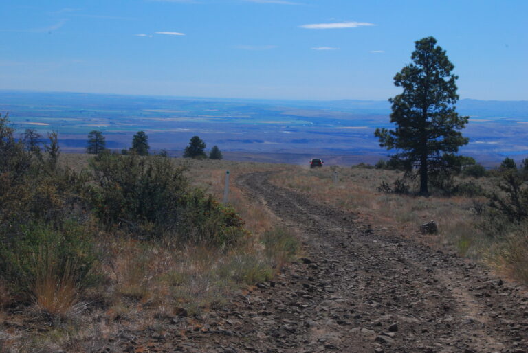
From Goose Lake, I took FS-6040 to Forlorn Lakes. This was the first road of the trip that lived up to the signage “Limited Maintenance.” Nothing difficult, but the ruts and water bar crossings limit the route to high-clearance vehicles.
From Forlorn Lakes, I intended to follow FS-6035 along the east perimeter of the Indian Heaven Wilderness Area; however, the sign said that the road was closed five miles ahead, so I followed FS-6030 to FS-6020 instead.

From FS-6020, I made my way to FS-24 along the northwest corner of the Indian Heaven Wilderness Area, past huckleberry meadows and Indian Camps of the Sawtooth Berry fields. The huckleberries are in season in August, and there are a lot of native Americans out picking them throughout this area.
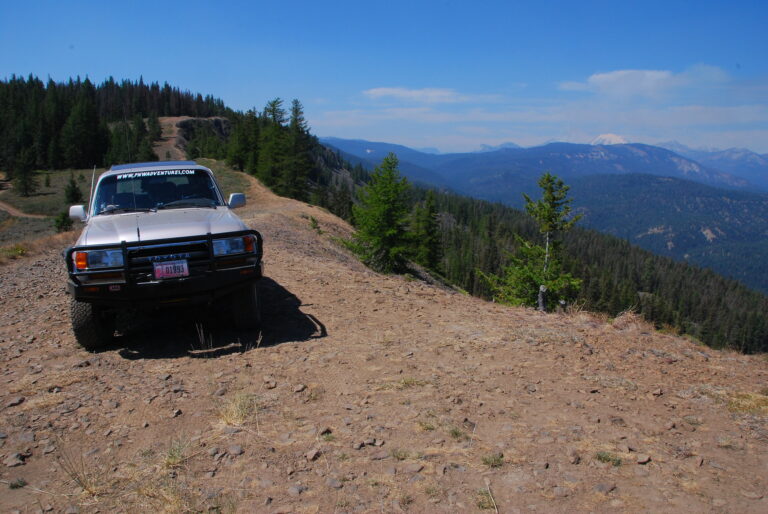
Once past the Twin Buttes area, I followed the native surface FS-8854 (another fun limited maintenance road) past Steamboat Lake to FS-8871 and then to FS-88.
From FS-88, I attempted to follow another primitive forest road (FS-150) but found the road blocked. I followed FS-200, which eventually became FS-150 in a few miles, and eventually, dead ends where a bridge once crossed the Lewis River at Twin Falls Campground. I had to then backtrack to FS-88. At least it was another limited maintenance native surface road. The national forest map is not very clear on this route.
Once back on FS-88, I followed it to FS-90. Ahead, FS-23 was washed out, so I detoured out of the valley on FS-585 (another primitive limited maintenance native surface road) to FS-2334 and onto FS-23.

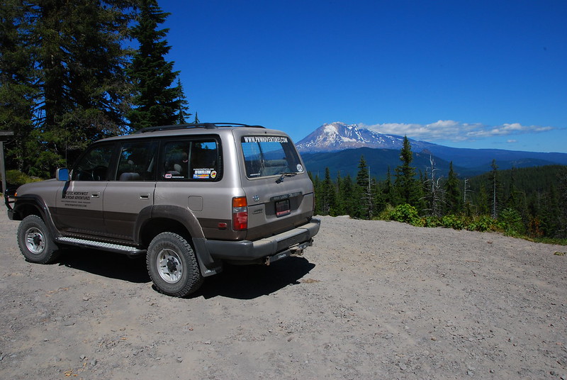
Once I reached Babyshoe Pass, I needed to find a campsite for the night. Just past the pass was FS-335, so I followed it up Babyshoe Ridge and found a great spot on top of the ridge to camp for the night. This spot provided a great view of Mt. Adams to the southwest and Mt. Hood further south in Oregon. Elevation 4690 feet.
I didn’t meet my goal of reaching Packwood, Washington. If a more direct route had been taken, it could have easily met the daily driving goal. It turns out I was about two hours short, considering my backtracking and driving the more primitive routes in the area.
Daily Summary:
Total Miles Driven (approximate) – 102 miles (Carson to Mt. Adams)
Paved Highway: 7.7 miles
Paved County Roads: 8.5 miles
Paved Forest Service Road: 16.2 miles
Improved Gravel Forest Service Roads: 55.4 miles
Limited Maintenance Forest Roads: 14.2 miles
See all the photos from this trip at Washington Cascades Overland Tour 2007 – Day One Photos.
Next Day: Day Two: Mt. Adams to Blewett Pass
Trip Report: Washington Cascades Overland Tour 2007 – Introduction
Trip Report: Washington Cascades Overland Tour 2007 – Day One
Trip Report: Washington Cascades Overland Tour 2007 – Day Two
Trip Report: Washington Cascades Overland Tour 2007 – Day Three
Trip Report: Washington Cascades Overland Tour 2007 – Day Four
Trip Report: Washington Cascades Overland Tour 2007 – Final Thoughts