Trip Report: Washington Cascades Overland Tour 2007 – Day Two (08.11.07)

Day Two: August 11, 2007.
Daily Goal: To Drive from Babyshoe Pass (on FS-23 near Mt. Adams) to Cle Elum, Washington (I-90).

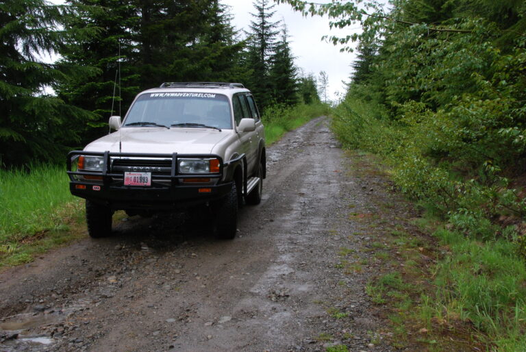
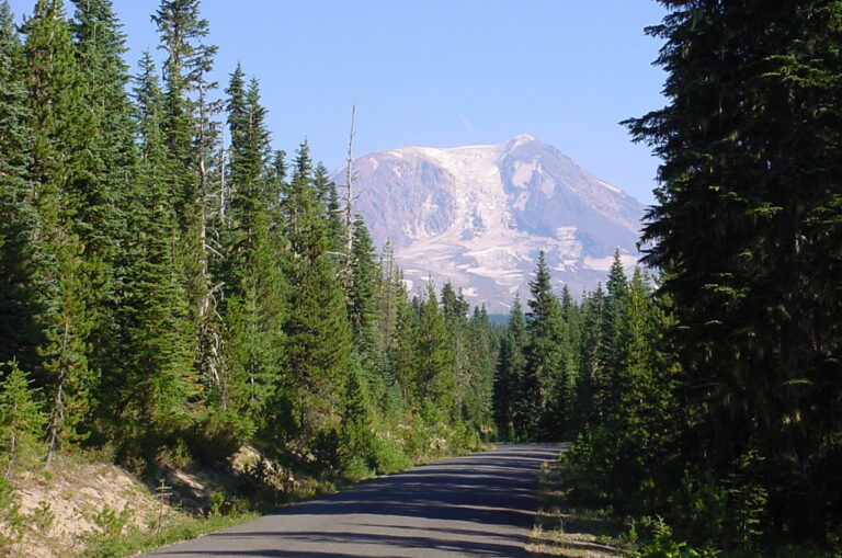
After a surprisingly comfortable night of sleep in the back of my 80-series Land Cruiser (with my dog Tareva right next to me), I arose just after daybreak to the awesome views of Mt. Adams and Mt Hood. This was my first attempt at sleeping in my FJ80. I initially had doubts about how comfortable it would be, considering my height. My newly built cargo box, the back seat folded down, a plastic tub on the second row footwell, and the front passenger seat folded forward and all the way to the dash provided great support for my air mattress. All that I had to do to rearrange from the day’s trip was to move the ARB refrigerator to the driver’s side and throw some of my bags in the front seats.
After securing my gear in the Land Cruiser and after a breakfast that included freshly picked huckleberries, I was on the road again.

From FS-23 at Babyshoe Pass, I headed north toward Takhlakh Lake and followed FS-2329 through the high country of the Mt. Adams area, past meadows and horse camps until it connected with FS-21. I then followed FS-21 out to Highway 12 and into Packwood for my first fuel stop (138.4 miles since leaving Carson, Washington).
My total driving time from Carson to Packwood was approximately 9.5 hours. This included a couple of side trips that added time, plus stops for photos to document the trip in my journal and rest stops for the dog (as well as myself). I believe that a person could easily drive this route in about eight hours, even less if one kept to the main forest routes (not as fun, in my opinion).
After fueling my Land Cruiser, I started on the longest stretch of paved road for the entire overland route – Highway 12 over White Pass to Rimrock Lake. Once past Rimrock lake, I headed north on FS-1500 (Bethel Ridge Rd.).

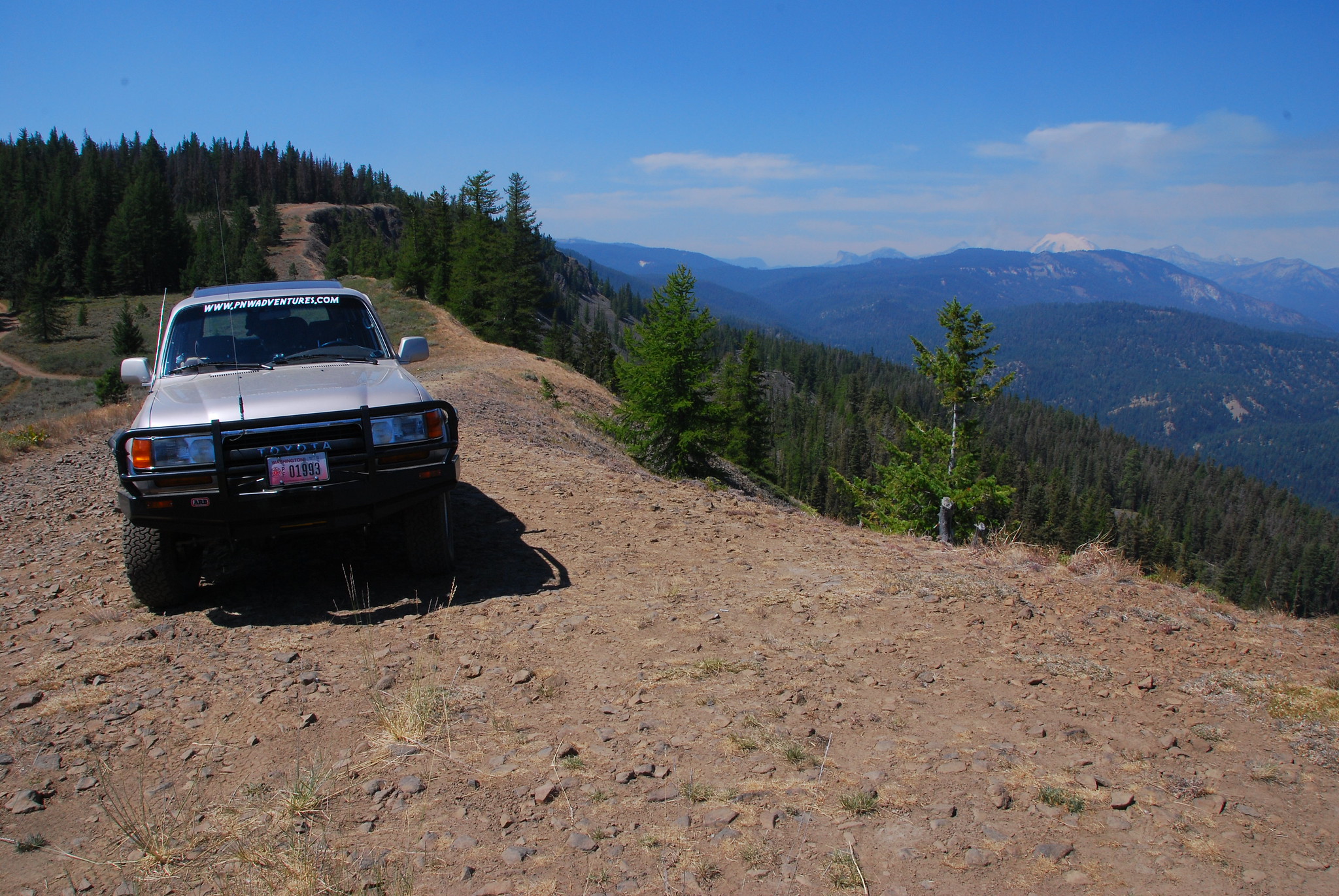
The fairly steep climb out of the valley on FS-1500 was probably the worse washboard I had ever driven. After about 7 miles, I reached the top of the ridge. My original intention was to drive FS-1500 to Highway 410. I had done this route last summer (see trip report Cascade Overland Adventure – August 2006), and it is a very scenic drive; however, my urge for adventure and to see new country led me on another detour of my originally planned route.
At the top of the ridge is FS-324, marked as Microwave, and leads to the towers. Just before the tower, there is FS-325. On the forest service map, it is designated as an “unimproved road” that would eventually lead me back to FS-1500 on the Naches River side.

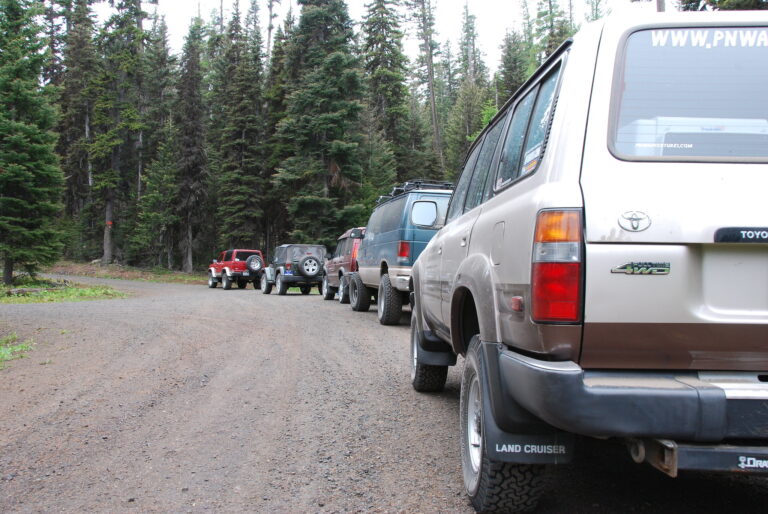
After a short distance, this road was marked as a designated four wheel drive route (difficulty: easiest). The road followed the south edge of Bethel Ridge out of the Wenatchee National Forest and into the Oak Creek State Wildlife Area. Although very rocky, there was nothing difficult on this route. Any stock four wheel drive could easily navigate it (at least when dry) without using low range (or even maybe engaging your transfer case into four wheel drive). Once you enter the wildlife area, the roads are not marked well. The forest service map shows the roads, but they are not labeled, and some are closed (green dot road management system). I eventually made my way down Bethel Ridge into the Rattlesnake Creek canyon, back to FS-1500, and to Highway 410.
The distance from Highway 12 to Highway 410, via the route I took, was approximately 32 miles and three hours of driving. If I had followed FS-1500 all the way, I would have saved about an hour or more of driving.

The next segment of the route was not clear on the forest service maps. My goal was to travel from Highway 410 to I-90 by way of Manastash Ridge. I knew there were designated four wheel drive trails that crossed over; however, since I was traveling solo, I wanted to remain on no less than unimproved roads.
From Highway 410 near Nile, FS-1701 looked promising because, at the top of Manastash Ridge, the forest map shows unimproved roads dropping down the other side and meeting up with FS-31 and the South Fork of Manastash Creek.
From Highway 410, you reach FS-1701 across the street from Jim Sprick Community Park near Nile, Washington. FS-1701 steadily climbs to the top of Manastash Ridge, first through sagebrush country and eventually through pine forests and open prairies.

After traveling the ridgeline for a while, you eventually leave the national forest land and enter state land. At this point, the road becomes known as the Barber Springs Road (of course, not marked in any way). Luckily I made the trip in the time frame I did because on Monday (8/13/2007), they were closing the road to install culverts. Not as well maintained as the forest service roads, the Barber Springs road winds its way down the north side of Manastash Ridge and meets up with FS-31.
I followed FS-31 west, past Buck Meadow, to the junction with the Quartz Mountain road. At this junction, I followed FS-3120/FS-3330 to FS-33 near Taneum Creek. Instead of following the main forest road to Cle Elum (FS-3300 to FS-4510), I took an alternative route over Cle Elum Ridge by following FS-133 to FS-119 to FS-3350 near Tillman Creek and into Cle Elum.

My total driving time from Packwood to Cle Elum was approximately 7.5 hours and covered approximately 128 miles.
After fueling up in Cle Elum and making a phone call home, I started to look for a campsite for the night. Originally, I was going to follow Highway 97 north out of Cle Elum and turn off on the road to Liberty, however, my desire to explore led me off and up the Teanaway River valley. According to the map, a forest road crossed over to Highway 97 near Blewett Pass, so I figured I could find a campsite somewhere along the way.
The scenic (paved) Teanaway Road follows the Teanaway River valley through farmland and eventually into national forest lands, where it becomes FS-9737. With limited time, I didn’t get a chance to explore the Teanaway Road past FS-9738.

From Teanaway Road, I headed east on FS-9738. According to the sign, Highway 97 was about 15 miles away. I ended up driving about 12 miles before I eventually found a campsite for the night. It ended up being a secluded clearing just off FS-9738. No views, but it was a quiet spot to stay for the night.
Daily Summary:
Total Miles Driven (approximate) – 189 miles (Mt. Adams to Blewett Pass)
Paved Highway: 50 miles
Paved County Roads: 17 miles
Paved Forest Service Road: 5 miles
Improved Gravel Forest Service Roads: 102 miles
Limited Maintenance Forest Roads: 15 miles
See all the photos from day two of this trip at Washington Cascades Overland Tour 2007 – Day Two Photos.
Next: Day Three: Blewett Pass to Cooper Mountain Lookout (near Chelan, Washington)
Trip Report: Washington Cascades Overland Tour 2007 – Introduction
Trip Report: Washington Cascades Overland Tour 2007 – Day One
Trip Report: Washington Cascades Overland Tour 2007 – Day Two
Trip Report: Washington Cascades Overland Tour 2007 – Day Three
Trip Report: Washington Cascades Overland Tour 2007 – Day Four
Trip Report: Washington Cascades Overland Tour 2007 – Final Thoughts