Trip Report: Washington Cascades Overland Tour 2007 – Day Four (08.13.07)

Day Four: August 13, 2007.
Daily Goal: To Drive from Cooper Mountain Lookout (near Chelan, Washington) to Chopaka (border with British Columbia)
Map Reference:
Okanogan National Forest Map
Since this going to be the last day of the trip and I had no idea how long it would actually take to complete my goal of reaching the British Columbia border at Chopaka. So I set my alarm to get up and be on the road by daybreak.
From my campsite on Cooper Mountain, FS-8020 (Cooper Mountain Rd.) continues to follow the Sawtooth Ridge in a northwesterly direction. Along the way, I saw several grouse standing in the middle of the road.
After about 45 minutes of driving the Cooper Ridge Rd., I turned onto FS-600 (not maintained for cars or tall vehicles) and then FS-4330 which led me off the Sawtooth Ridge into the South Fork Gold Creek drainage. Along this section of road, I saw a nice forkhorn buck that didn’t stay around very long.
At the end of FS-43330, I turned left on FS-4340 as it followed the North Fork Gold Creek upstream. Along the way, FS-4340 passes over Gold Ridge, to the Libby Creek drainage where it meets FS-43.
Heading north on FS-43 led me past Black Pine Lake and then followed Buttermilk Creek and eventually to the Twisp River Road. Once on Twisp River Rd., I headed east until I reached Elbow Coulee Road. Elbow Coulee Rd. leads along the western edge of the Methow Wildlife Area, past Big Twin lake and into Winthrop, Washington. Like Leavenworth has the Bavarian theme, Winthrop has the Western theme for it’s downtown, right down to wooden sidewalks. It’s a busy place on summer weekends.
The trip from Chelan to Winthrop, as driven, was approximately 90 miles and took about 4.5 hours to drive.
After a quick fill up of fuel, I headed out of town following the East Chewuch River Rd. until I reached Boulder Creek. From the East Chewuch River Rd., I headed east on FS-37, following Boulder Creek, then the Middle Fork of Boulder Creek. After about seven miles of driving FS-37, there was a sign stating that the road was closed due to construction 5.6 miles ahead. The first thing I thought was “great, another detour and/or backtrack”. After looking at the forest service map, I estimated that the maintenance was close to where FS-37 had a junction with FS-39 and if I was lucky, I could travel one of the those routes. I drove the 5.6 miles and still no road construction. I reached the junction with FS-39 and still no closure. My original intention was to follow FS-37 to FS-39, however I could hear heavy equipment operating from what sounded like FS-39, so I continued on driving FS-37 into Conconully.
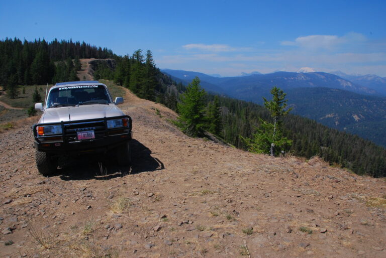
From the junction with FS-39, FS-37 climbed up and over Baldy Pass (elevation 6515 feet) before descending into the Conconully area. FS-37 provides some great views on both sides of Baldy Pass, including some extensive views towards Conconully and the Columbia Basin. I reached Conconully in about 51 miles and about two hours of driving.
After a quick fuel stop (not really necessary but I always top off for a safety factor) with the most expensive fuel of the trip ($3.69/gallon — ouch. Luckily I only needed less than 4 gallons), I headed out of Conconully on the North Fork Salmon Creek Rd. which becomes FS-38. From Salmon Meadows, I followed FS-3820 which climbed its way to Lone Frank Pass, passing through state land (limited maintenance = fun road), over Lone Frank Pass (elevation +6300 feet) and meeting up with FS-39 (about twelve miles from where I was earlier in the day).
Driving north along FS-39 provides some great views to the Cascades and well as the local terrain. As FS-39 travels in and out of different drainages, you can see South and North Twentymile Meadows down below you and you pass through Thirtymile Meadows. This region is a designated snowmobile area and I could see why. High altitude and a lot of meadows to have play in.
As I approached Dog Creek, I finally found the road construction the sign spoke of earlier. I had to wait for about five minutes as a water tender filled up from Dog Creek. Then I passed several pieces of operating heavy equipment. This was the first time that I made fresh tracks on a freshly graded forest road.
FS-39 turns into a paved road at Long Swamp and eventually turns into Toats Coulee as it heads east and meets the Loomis-Oroville Road. I headed north on the Loomis-Oroville Rd., passing Palmer Lake. Once past the lake, I turned left on the gravel Chopaka Road as it passed farms, old abandoned historic buildings, following the Similkameen River valley.
All the maps that I have show the the road leads to the border with British Columbia. Well I was disappointed when I found that access is blocked by a gate with no trespassing signs. The best that I could determine was that the road ends about one mile short of the border. I’m sure this has to do with Homeland Security issues. At roads end, there is a Washington Department of Fish and Wildlife public access area so I drove as far as I could and by time the road ended, I was about 0.75 mile from the border with no way to go further north (48º 59′ 18″ N, 119º 43″ 11″ W)
Since I was so close, I thought I might as well make the actually trip to the border, so I back tracked on the Chopaka Rd. and continued on north through small community of Nighthawk onto the border crossing into British Columbia (this port of entry has limited hours if you plan on passing through at this point) where I officially completed my four day, north-south cross state tour of Washington state through Cascades.
Now time for the five hour drive home.
The trip from Conconully to the British Columbia border, as driven, was approximately 70 miles and took about 3.5 hours to drive.
Daily Summary:
Total Miles Driven (approximate) – 179 miles (Cooper Mountain Lookout to Chopaka)
Paved Highway: 0 miles
Paved County Roads: 76 miles
Paved Forest Service Road: 4 miles
Improved Gravel Forest Service Roads: 95 miles
Limited Maintenance Forest Roads: 4 miles
See all of the photos from day four of this trip at Washington Cascades Overland Tour 2007 – Day Four Photos.
Next: Final Thoughts
Trip Report: Washington Cascades Overland Tour 2007 – Introduction
Trip Report: Washington Cascades Overland Tour 2007 – Day One
Trip Report: Washington Cascades Overland Tour 2007 – Day Two
Trip Report: Washington Cascades Overland Tour 2007 – Day Three
Trip Report: Washington Cascades Overland Tour 2007 – Day Four
Trip Report: Washington Cascades Overland Tour 2007 – Final Thoughts