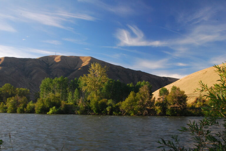
Rogue River-Siskiyou National Forest Announces Final Decision on Motorized Vehicle Use (Oregon)
Contacts:
Steve Johnson, Interdiciplinary Team Leader, (541) 552-2900
Paul Galloway, Acting Public Affairs Officer, (541) 618-2113
MEDFORD, OR – January 20, 2010 – The Rogue River-Siskiyou National Forest has recently completed a Travel Management Plan that shows roads, trails and areas open to motorized vehicles. This week the Forest released a Record of Decision for Motorized Vehicle Use on the Rogue River-Siskiyou National Forest. The Record of Decision designates Alternative 5 of the Final Environmental Impact Statement as the final decision on motorized vehicle use.
“This new strategy meets the purpose and need for the project, providing for a balanced, managed system of motorized use while addressing the environmental and social issues the agency heard from the public during the travel management process,” said Rogue River-Siskiyou National Forest Supervisor Scott Conroy.
Categories: Access Tags: camping, forest service, motorized vehicle, national forest, off-road travel, oregon, rogue river-siskiyou national forest, travel management plan
New ARB Sport Camp Chair
Seattle, January 4/ ARB 4×4 Accessories/ – One of the biggest problems with camping chairs on the market today is that they are built to meet a price point which effectively means they are not built to last. So when ARB started looking for a camp chair, number one on the list of priorities was strength and durability.
Categories: Press Releases Tags: 4x4, 4x4 accessories, arb, camp chair, camping, camping chairs
Proposal for Motorized Trail System on the Ochoco National Forest (Oregon)
For Immediate Release:
November 18, 2009
Contact: Virginia Gibbons 541/416-6647
Bill Queen 541/416-6500
Prineville, OR – A proposal for a designated motorized trail system on the Ochoco National Forest is currently available for public review. The “Ochoco Summit OHV Trail” would be located east of Highway 26 on Forest Service-administered lands in the general vicinity of Big Summit Prairie on the Lookout Mountain and Paulina Ranger Districts. The project includes 124 miles of motorized trails that would be used, in a varying capacity, for ATV, motorcycle, jeep, small truck and buggy recreational riding. The trail system includes a number of staging areas, trailheads, camping opportunities, riding areas and interconnected trail loops.
Prior to this proposal, the McKay Creek area was considered for a designated motorized trail system. Ochoco National Forest Supervisor Jeff Walter felt it made good sense to conduct an analysis for a designated motorized trail system in McKay watershed that could be managed and enforced. The McKay watershed has sustained significant resource damage from illegal OHV use for a number of years and more recently, the reintroduction of steelhead into the McKay Creek system has created additional concerns. However, upon review by local citizen groups and cooperating agencies affiliated with the Deschutes Provincial Advisory Committee and the Crook County Natural Resource Planning Committee, the proposal for a motorized trail system in McKay was not well supported.
The Forest recognizes that not all of the issues have been resolved with the Ochoco Summit OHV Trail Proposed Action and that many people have yet to provide input. It is important to note that the proposal is just the starting point in this planning process. Issues that are unresolved, or that emerge as a result of public input will be addressed through a modification of the “Proposed Action” and/or through the development of alternatives that will be analyzed and compared in the Draft Environmental Impact Statement (DEIS).
We anticipate the public comment period for this Proposed Action will begin on November 20, 2009 and end on December 21, 2009, pending publication in the Federal Register. The Proposed Action, maps, and additional information is posted on the forest website at www.fs.fed.us/r6/centraloregon/travel-mgmt/och_summit/index.shtml
Comment forms and a comment inbox are also available on the website. Those who wish to view printed paper maps or receive an electronic copy of maps on CD may go to thefollowing locations:
Ochoco National Forest Supervisor’s Office
3160 NE 3rd Street, Prineville, OR 97754
Rager Ranger Station (Paulina Ranger District)
171500 Beaver Creek Road
Paulina, OR 97751
Crooked River National Grassland
813 SW Hwy 97
Madras, OR 97741
A CD may also be requested by contacting the Ochoco National Forest at (541) 416-6500. Hard copy comments may be mailed or delivered to:
Ochoco Summit OHV Trail Planning Team
Ochoco National Forest
3160 NE 3rd Street
Prineville, OR 97754
The Ochoco Summit OHV Trail DEIS is tentatively scheduled to be available for public review and comment in the spring of 2010. Public meetings and a 45-day public comment period will be scheduled and announced at that time. A Final Environmental Impact Statement and Record of Decision is tentatively scheduled for completion in the summer of 2010.
The Ochoco Summit OHV Trail Proposed Action is not to be confused with the “Travel Management DEIS” for the Ochoco & Deschutes National Forests. The Ochoco Summit OHV Trail is a separate analysis from the Travel Management DEIS, and it is consistent with the direction stated in the “Forest Service 2005 Travel Management Rule”.
For more information on the Travel Management DEIS, which is currently available for review and public comment, please visit our website at www.fs.fed.us/r6/centraloregon/travel-mgmt
For specific project information regarding the Ochoco Summit OHV Trail Proposed Action, contact Dede Steele, Project Lead, at (541) 416-6500. For general concerns and questions regarding the Ochoco Summit OHV Trail proposal, contact Bill Queen, Lookout Mountain District Ranger (541) 416-6500; Slater Turner, Acting Paulina District Ranger (541) 416-6900; or Virginia Gibbons, Public Affairs Officer, (541) 416-6647.
http://www.fs.fed.us/r6/centraloregon/news/2009/11/20091118-ochsum-propmotor_trail_ochoco_nf.pdf
Categories: Access Tags: atv, big summit prairie, camping, crook county, crooked river national grassland, forest service, jeep, madras, mckay creek, motorcycle, motorized trail system, national forest, ochoco, ochoco national forest, ochoco summit ohv trail, ohv, oregon, paulina, prineville
State DNR to hold public meeting on Reiter Foothills Forest Recreation Plan
FOR IMMEDIATE RELEASE
November 6, 2009
OLYMPIA – The Washington State Department of Natural Resources (DNR) will host a public meeting to provide information and receive public comments on a draft recreation plan for the Reiter Foothills Forest.
Reiter Foothills Forest is a popular recreation area located in eastern Snohomish County near Gold Bar and Index.
When: Wednesday, November 18, 6:30 to 8 p.m.
Where: The Commons, Monroe High School, 17001 Tester Rd., Monroe
In 2007, the Washington State Legislature recognized the challenges of managing recreational use at Reiter Foothills Forest and funded DNR’s development of a sustainable recreation plan. For the past two years, DNR has worked with a diverse group of stakeholders – including citizens, user groups, representatives from conservation groups, and local officials – to create a recreation plan that identifies long-term recreation uses and addresses problems in the area.
In addition to Reiter Foothills Forest, DNR is also doing sustainable recreation planning for two other forest areas in Washington State: Ahtanum State Forest near Yakima and the western portion of the Yacolt Burn State Forest, north of Washougal.
DNR will release the draft Reiter Foothills Forest Recreation Plan on its web site on Tuesday, November 10. DNR is requesting feedback from the public about the findings and recommendations in this plan. In conjunction with the public review of the plan, DNR is also conducting an official State Environmental Policy Act (SEPA) process. The public comment period runs from November 10 through December 4.
For more information about the meeting, contact Candace Johnson, 360-854-2803 or candace.johnson@dnr.wa.gov .
The public can provide all written comments about the Reiter Foothills Forest Recreation Plan or the SEPA environmental analysis to:
Washington State Department of Natural Resources
SEPA Center
PO Box 47105
Olympia, WA 98504
sepacenter@dnr.wa.gov
Recreation On DNR-Managed Lands
DNR manages more than 5 million acres of state-owned forest, aquatic, agricultural, conservation and urban lands. Most recreation on these lands takes place in the 2.2 million acres of forests that DNR manages as state trust lands. By law, state trust lands are managed to produce income for schools, universities, prisons, state mental hospitals, community colleges, local services in many counties, and the state’s general fund. State trust lands are also managed to provide fish and wildlife habitat and educational and recreational opportunities.
DNR-managed lands provide 1,100 miles of trails, 143 recreation sites, and a variety of landscapes throughout Washington State. Recreational opportunities include hiking, hunting, fishing, horseback riding, camping, motorized vehicle riding, mountain biking, and boating.
DNR’s main recreation focus is to provide trails, trailhead facilities, and a primitive experience in a natural setting.
Media Contact: Toni Droscher, Recreation Program Communications Manager, 360-902-1523 or toni.droscher@dnr.wa.gov .
Categories: Press Releases Tags: ahtanum state forest, boating, camping, department of natural resources, dnr, fishing, gold bar, hiking, horseback riding, hunting, motorized vehicle riding, mountain biking, recreation, recreational, reiter foothills forest, snohomish county, washington, washington state, washington state department of natural resources, washougal, yacolt burn state forest, yakima
ARB Touring Series III – Camp in style with ARB’s new Rooftop Tent, Annex & Awnings

ARB Rooftop Tent
FOR IMMEDIATE RELEASE
Seattle, February 5/ ARB 4×4 Accessories/ — ARB is proud to announce the impending release of the Series III range of Simpson tents, annex, awnings and various accessories. With over six months of re-design work and moving to a new factory for improved quality assurance, the Series III tent incorporates an updated design and new materials for better strength, rigidity and water resistance.
Categories: Press Releases Tags: 4, accessories, annex, arb rooftop tent, awning, camp, camping, mosquito net, products, simpson, simpson tent, tent, touring
Trip Report – Gnatt Creek Area – August 2008
Accrete posted up a great trip report and some great photos of a recent trip into the Gnatt Creek Area of the Clatsop State Forest in Oregon.
Read more at OR_NorthCoast_Gnat Creek Area_2008-08
Categories: Adventures Tags: camping, clatsop state forest, gnatt creek, oregon
Idaho BLM to Host Open House on New Resource Management Plan
The Bureau of Land Management (BLM), Idaho Falls District, is preparing a new Resource Management Plan (RMP) for the Upper Snake Field Office (FO) in southeastern Idaho. The Upper Snake RMP will cover the planning areas currently managed under three management framework plans (MFPs) and one RMP: the Big Desert MFP (1981), Big Lost MacKay MFP (1983), Little Lost/Birch Creek MFP (1985), and the Medicine Lodge RMP (1985). The Upper Snake RMP will replace these four land use plans, resulting in a single RMP for the entire Upper Snake FO.
Categories: Access Tags: blm, bureau of land management, camping, idaho, idaho falls, land use, off-highway vehicle use, recreation, resource management plan, rmp, snake river
