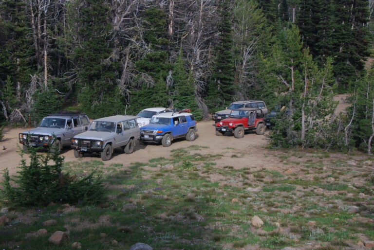
High Rock Loop Overland Tour, Washington – 06.24.2007

Summer in Western Washington usually doesn’t start officially (at least weather-wise) until July 5 of each year. Today (06.24.2007) was no exception. The forecast for the day was for rain and a snow level of 5000 feet.
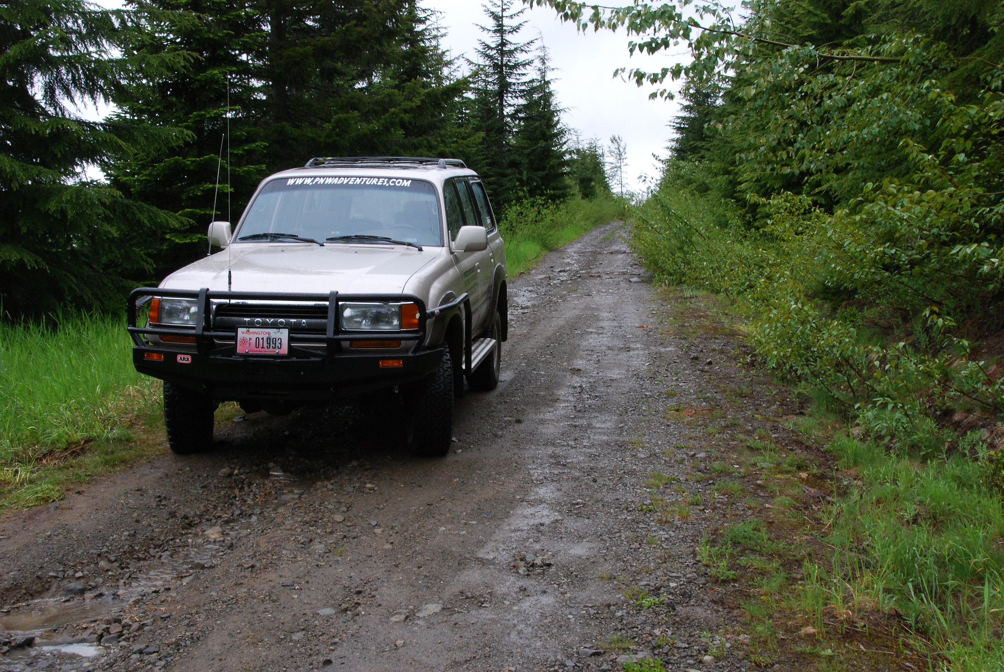
Since I worked the night before and my wife’s nephew was coming over for dinner, I had to keep the day’s adventure somewhat local from my home. Flipping through the book “Washington Byways”, I found “Tour 49 – High Rock Lookout Loop”, which fit perfectly into the day’s time restraints. I loaded the dog in the Land Cruiser and headed towards the Cascades, hoping to find some sun above the low-hanging clouds.
To reach the High Rock Lookout area, I traveled east on State Route (SR) 706 from Elbe, Washington, towards Mt. Rainier National Park. After about two miles East of the community of Ashford, I made a right turn (south) on Forest Road (FR) 52 (also known as the Skate Creek Road and also Kernahan Rd. E).
After following FR 52 for about 4.7 miles from SR 706, I turned right on FR 84. FR 84 is a narrow, one-lane, pot-holed, gravel road that steadily climbs once it crosses Big Creek. The perfect type of road for an adventure.

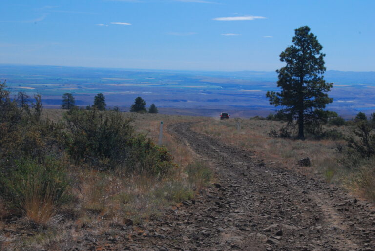
After driving about 1.5 miles on FR 84 (the road condition eventually improved), I decided to adventure away from the main forest road and drive up FR 8410 to see what was there. From FR 84, the condition of FR 8410 is surprisingly good as it gradually climbs through the forest, even passing some old-growth stands of timber.
After about 3.2 miles, the condition of the road becomes a little rougher due to erosion from the past fall and winter. At about 3.8 miles, I passed the Teeley Creek Trailhead (Trail No. 251) and parking area. There were several vehicles parked there, probably enjoying the wet trail conditions. (NOTE: The trailhead sign says “Tealey” and the forest service website says “Teeley”).
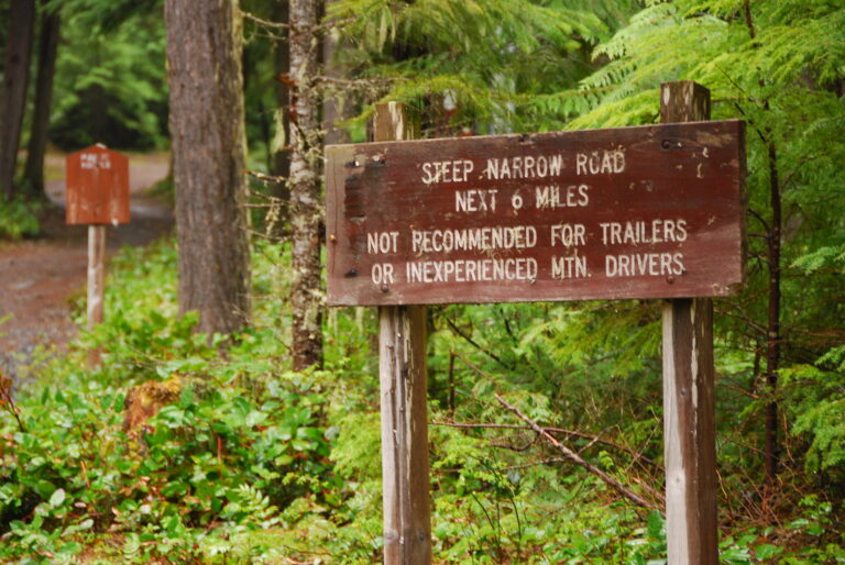
The Teeley Creek trailhead marked the end of the well-maintained road. FR 8410 became much steeper, narrower, and rutted due to erosion. Even though a high clearance two-wheel drive vehicle may have made it up this section, I engaged my low-range four-wheel drive to prevent further road damage due to spinning tires.
At about 4.6 miles, I came to my first obstacle across the road. It was an eight to ten-inch tree that had fallen across the road. Since I had my old ax in the Land Cruiser (and the rain had stopped), I wasn’t going to let a small tree get in my way, so I proceeded to get my cardio workout for the day to clear the way. Once the tree was down and de-limbed, I drove over the tree and onward to the road’s end.

The higher in elevation I drove, the more snow patches I encountered. Finally, I met a large tree blocking the road, ending the exploration of FR 8410 for the day (plus, it was raining hard at this time). It would have taken a while to chop the tree by hand, and the chances were I wouldn’t be able to drive over it with my Land Cruiser anyway. Luckily there was a wide spot in the road to turn around (elevation 4347 feet).
I imagine the views from FR 8410 were awesome once past the Teeley Creek trailhead. I saw the occasional glimpse of peaks and valleys below through the clouds.

Once I got back to FR 84, it gradually climbed in elevation. The first wildlife sighting of the day was a large hawk that swooped down and flew just above my sunroof for a few hundred feet and then landed in a tree. The hawk stayed in one place long enough to get a photo before flying off. Along the way, there were a couple of other spur roads to explore (FR 8420 and FR 8430), but I elected to pass on them today.
The only vehicle I saw after leaving the Tealey Creek Trailhead was a Jeep Grand Cherokee dragging a snowmobile down FR 84, followed by a Jeep Wrangler. From the looks of the snowmobile, it appeared that it might have been stranded since last winter.
At approximately 6.8 miles on FR 84 is the turn-off to High Rock Lookout (FR 8440). FR 84 will take you into Packwood or Randle, Washington at this junction, depending on the route chosen.

About 2.6 miles from FR 84, FR 8440 brought me to Towhead Gap (elevation 4307 feet) and the High Rock Lookout trailhead (Trail 266). In the opposite direction from the High Rock Lookout was another trail. It appeared to be a double track that followed the ridge line in the opposite direction. There was a sign that was the object of some illegal target practice, so it was hard to read. According to the forest service map, it looked like it was Trail 253. The double track looked drivable, but being alone and not knowing if this was a legal trail for motorized vehicles, I left it alone. (NOTE: Later, I found it was the Greenwood Lake Trail #253 and is open to all uses except four-wheeled vehicles).

From Towhead Gap, FR 8440 drops into the Catt Creek valley. The road was heavily rutted in places due to erosion. Through the clouds, there were views of the valley below.
After about 7.5 miles on FR 8440, I came to the junction with FR 85. If you took a left (South), FR 85 would eventually lead you to Randle. I took a right and headed back towards SR 706.
FR 85 was once a two-lane paved road and has seen little recent maintenance. It’s now a moss lined one lane paved road with turnouts. Overall, the condition of the asphalt is in good condition.

On the forest service map, I noticed a network of roads on the opposite side of Catt Creek that were DNR roads. I eventually located the access point and found it was gated off to prevent access. Too bad.
After about 6.5 miles on FR 85, the road ends at FR 52 and the junction of SR 706 (Osborne Rd. E. and Paradise Estates). This was the first location I saw another vehicle since I saw the Cherokee pulling the snowmobile.
Overall, this is a nice drive that can be driven in a couple of hours if you want to explore some other area roads or hiking trails. A high-clearance vehicle would be desirable but not necessary (you’ll have to navigate potholes and eroded roads). Distance wise, it’s only a little over 20 miles to complete the loop. However, you feel like you are more in the backcountry than this. Not passing many other vehicles probably made it seem a little more remote.

From the pictures I’ve seen, the views from this area are fantastic if the weather cooperates. It didn’t for me, but it was still a beautiful area, even under the cloud cover. I’ll have to come back and revisit the area on a sunny day.
To view a few more photos from this adventure, please visit http://www.flickr.com/photos/locked4low.