Archive for September, 2007

Tour Announcement - Burley Mountain to Mt St Helens 10/13/07

In case you missed it on the forum, I posted an announcement for a tour of the Mt. St Helens area south of Randle, Washington.

The plan is to visit the Burley Mountain Lookout, drive the ridgeline between Greenhorn Buttes and Mosquito Meadows, visit Windy Ridge at Mt St Helens and more depending on time.

Read more of the trip details at Burley Mountain to Mt St Helens Tour

Posted in Adventures | No Comments »

Evans Creek ORV Trail Run (Washington) - 09.20.07

Evans Creek ORV Trail Run (Washington)

A couple of my coworkers (Adam and James) had been planing a trail run to Evans Creek ORV for a little over week. My wife had plans to volunteer that day so I kept saying no. Finally, Thursday came and Adam needed to use my jigsaw to do a little wheel well trimming on his Jeep. Well my wife’s plans for the day changed and she said to go. Sweet.

Knowing very well that the trail system at the Evans Creek ORV area was not designed to larger vehicles like my Toyota FJ80 Land Cruiser, my intent was that we would stick to the easier trails and/or forest roads. So off we went for the day’s adventure.

Evans Creek ORV Trail Run, Washington Once we pulled into the parking lot of the Evans Creek, we were met by a group of three other Jeeps. We decided to tag along. The emotional fun of wheeling overcame my common sense that my Land Cruiser may not fit on the trails. Luckily there there was minimal recent rain.

I’m not sure what trail we started on because there was no sign (unless I missed it). I know it was just west of the day use parking area. We started off climbing from the road shortly an obstacle that gave a couple of the Jeeps a challenge. Basically the key was to keep to the left of a few rocks in the trail (easier said then done). The long wheelbase of my Land Cruiser definitely helped in this section. Because the trail was relatively dry, it was a pretty easy time in my FJ80 and the trail provided plenty of width to navigate my 112 inch wheelbase through the obstacles (if you’re not familiar with my Land Cruiser, I’m only running an 2.5 OME lift, 31 inch BFG AT tires and unlocked diffs).

Evans Creek ORV Trail Run, Washington We eventually came to trail 198 (which was marked “most difficult”). I was having fun and the trail wasn’t bad so far, so I decided to continue with the group. Well this section of trail ended up being very tight for my 80-series pig. There was quite a few close calls where the off camber sections would push me very close obstacles along side of the trail. I made several attempts to get around certain root but in the end, my flare hit it and I heard a cracking sound. I thought the flair was toast. Somehow, I managed to get by with only deep scrapes in my left rear fender flair.

A little further down the trail, there was a turn that I didn’t think I could make so I tried a alternate route. The path would initially lead me between two trees (with minimal clearance on each side). I should have gotten out and sized up the obstacle first, but I didn’t. I drove up over the roots of the tree and then got high centered on my side steps when my front tires dropped into the hole on the other side. Evans Creek ORV Trail Run, Washington Had I built up a ramp with readily available materials (logs and rocks) I probably would have negotiated the obstacle. To continue, I had to get winched off (the only time all day). After that, the trail was still tight but I was able pass the remaining tight sections with out problem (just throw in a few multi-point turns and some spotting).

After we reached the gravel forest road, we headed up Forest Road 7930 until we reached the ridge. Normally you have a great view of Mt. Rainier from this location but today, you could only see the lower part of the glaciers. In the opposite direction, there are views of the Puget Sound lowlands, however those views were limited by the cloud cover.

Evans Creek ORV Trail Run, Washington By this time, one of the Jeeps in the group headed out, so we took a little time to fire a few rounds through our guns. It had been a while since I shot my 9mm Ruger, but I was actually able to hit a fairly decent grouping at 20 yards. Adam had his .44 Smith cannon and shot a few rounds also.

After making some noise, we headed down to the main road in, stopping to play and take some photos along the way.

We were able to air up at Chuck’s Service & Gas in Wilkeson. We real appreciated the hospitality because air is not a normally provided service. At one time it was, but a few people ruined for everybody.

Evans Creek ORV Trail Run, Washington It was a fun day. If the weather was clear, I could have had some great pictures of Mt. Rainier. I got lucky that the conditions were mostly dry (except for a few puddles). If it had been wetter conditions, my BFG ATs would not have had any traction and I would have probably ended up sliding into something and denting a quarter panel (like James in his Cherokee). The only damage I suffered was some deep scrapes in the left rear fender flare and a little tweaking of my side steps. Would I take my Land Cruiser on those trails again? On the forest roads, not a problem. On the 4WD trails. Nope. The FJ80 is just too much body and wheelbase.

You can view all of the photos from this trail run at Evans Creek Trail Run Photos.

Posted in Adventures | No Comments »

Sportsmen United for Sensible Mining

Tags: , , , , , , , , , , Saturday, September 22nd, 2007

American hunters and anglers were some of our nation’s first conservationists. Led by Theodore Roosevelt, sportsmen called for laws regulating sustainable fish and wildlife populations and set the stage for foundation of the North American wildlife conservation model, an enduring legacy. On Saturday, Sept. 22, sportsmen will celebrate National Hunting and Fishing Day, honoring the history that unites us and planning for the future of the activities we love.

National Hunting and Fishing Day is an appropriate occasion for considering a legacy of a different kind - an unfortunate legacy that continues to negatively impact American hunting and fishing and that calls the future of our sport into question. More than a century of hard rock mining on America’s public lands has left its mark on fish and wildlife populations. The TRCP is working to correct the problem, and we urge sportsmen to join in an effort to reform the 1872 Mining Law.

Currently, a movement is afoot in Congress that has great potential for real change. House Natural Resources Chair Nick J. Rahall has introduced a bipartisan solution to the mining problem: HR 2262, the Hardrock Mining and Reclamation Act of 2007. Sportsmen must get involved now to protect the future of hunting and angling. Sportsmen United for Sensible Mining represents millions of hunters and anglers, fish and wildlife professionals and citizens who enjoy our public lands.

Take action to ensure that sportsmen’s interests - and the interests of America’s fish, wildlife and public lands - continue to be represented in HR 2262. Contact your members of Congress and ask them to support the campaign’s four tenets for sensible mining reform.

Sign up for the Sportsmen United for Sensible Mining Campaign.

Tell a friend about Sportsmen United for Sensible Mining.

Send a letter to the following decision maker(s):
House Natural Resources Committee

Below is the sample letter:

Subject: Support HR 2262 and Uphold Sportsmen’s Interests in Mining Law Reform

Dear [decision maker name automatically inserted here],

As a constituent who loves to hunt, fish and enjoy the outdoors, I strongly urge you to support sensible hard rock mining reform that will make it possible to continue these pastimes.

For many years, Congress has considered reform of the General Mining Law of 1872. While America’s economies, cultures and politics have changed during the past 135 years, its mining law has not. More than 270 million acres of federal land are open to hard rock mining under the law, mostly in the Rocky Mountain West. Because the law has not been meaningfully reformed, many of America’s most treasured public lands are at risk.

As you consider legislative reform of the 1872 Mining Law, I urge you to consider the following recommendations:

- Assess a royalty from any minerals taken from public lands to fund fish and wildlife conservation programs and abandoned mine reclamation.

- Strengthen protections against mining impacts for fish, wildlife and water resources.

- Allow “Good Samaritan” reclamation incentives and common-sense liability relief.

- Prohibit patenting or sale of public lands.

Moreover, I ask that you work to uphold environmental standards currently in the bill, including provisions that prevent new claim-staking in roadless areas and on special places and that place time limits on mine permits other than “life of mine.” Doing so will help conserve millions of acres of American lands and fish and wildlife habitat and will uphold the sportsmen’s opportunities and local economies that depend on them.

Thank you for considering my recommendations.

Sincerely,

[your name]

Posted in Access | No Comments »

Exploring the Forest Roads Above Wilkeson, Washington - 09.17.07

Toyota FJ80 Land Cruiser

Since most of what I needed to do at home required me to have dry weather to work on, I decided to take a ride to the forest lands above Wilkeson, Washington. Luckily for me, from my front door to the gravel forest roads of the Wilkeson Tree Farm (owned by Plum Creek) is exactly 20 miles. The drive time, depending on traffic will vary from 30-60 minutes. My goal was to explore Forest Service (FS) Road 7720. It had been a few years since my last visit to the area.

Wilkeson Washington Unfortunately, the weather did not allow for the great views of the Puget Sound lowlands below or to Mt. Rainier above. I’ll have to save that for another trip.

I started out from downtown Wilkeson, Washington and turned on Railroad Ave and drove past the historic Wilkeson School (the oldest operating elementary school building in Washington state), past the old Coke Ovens and the Wilkeson Sandstone Quarry and then turned up the hill near the entrance of the Sunset Lake Camp. None of the roads in this area have signs. The only road that shows on the Mt. Baker-Snoqualmie National Forest map is FS 7720. My GPS initially listed this road as the South Prairie Creek Road.

Meadows in the Forest near Wilkeson, Washington Once I climbed out of the valley, there is a section of the road that is the haul road for another quarry further up the road. After a short distance, there is a fork in the road, with the quarry road to the left (very obvious) and FS 7710 to the right. In a short distance I turned left on FS 7720 and followed it up the South Prairie Creek valley.

It wasn’t too long after this that my GPS showed no roads. So with no map or GPS showing the roads, I began to explore the area. I decided to drive up to roads end and work my way back down as time allowed. I climbed for a while when I came to a junction with two well used roads. First I chose the road to the right which dead ended in about two miles. Some great views through the mist. Probably better on a clear day. So I backtracked down to the last junction.

Cedar Lake through the Mist, near Wilkeson, Washington Next, I followed the road to the left. From what I could tell from the forest service map and the geography, this road was FS 7720. From this junction, the road was overgrown with alder trees in sections, steep, rocky and rutted in others. A high clearance vehicle would be recommended to travel this area of road. After passing multiple forks in the road, while staying to the left, I eventually came to an overlook into the valley and Cedar Lake. A nice mountain lake downhill from my vantage point. There appears to be a road within a relatively short distance from the lake’s outlet (it would still require a hike through the brush), but from where I was standing and without a map, I couldn’t tell you how to get to the road.

Misty Mountains Across the Valley, near Wilkeson, Washington South Prairie Creek, near Wilkeson, WashingtonWhile looking at the forest service map, I noted that there was a trailhead for Trail 1178 at the end of the road (only a short distance further). Once I got home and started writing this trip report, I found out that this was the Clearwater Trail #1178. After some photos of Cedar Lake and driving to the end of the road, I turned around and started heading down for further explorations.

Some of the spur roads I explored dead ended rather quickly, some were very overgrown with alder trees. Limb risers on my Land Cruiser would have been nice, or just simply turning around as what I had to do on FS 7724 because it was too overgrown.

Because of time limitations and a storm blowing in with visibility dropping to about 50 yards, I opted to head home for the day around 3:00 PM. I made note of some of the other roads I needed to explore on a future trip to the Wilkeson Tree Farm.

You can view all of the photos from this trip at Wilkeson Forest Roads.

Posted in Adventures | No Comments »

Deception Pass to Cape Flattery, Washington - Sept 8-9, 2007

Cape Flattery Lighthouse, Washington

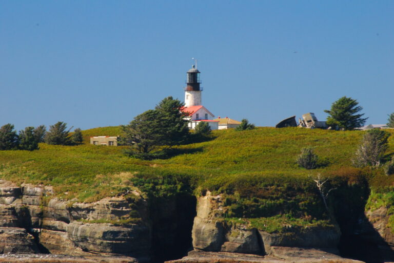
Initially, the family was only going to make a day trip to Oak harbor, Washington to visit friends for the day. However, since the forecast was for nice weather over the weekend, I suggested that we stay over night in a hotel and take the Keystone-Port Townsend ferry over to the Olympic Peninsula the next the morning and do some sight seeing. I suggested Cape Flattery as one possible destination.

Saturday morning, we made it out the door and headed North on I-5. The closer we got to Seattle, you could easily tell that there was a University of Washington Huskies football game in town by the school colors that were on nearly 1 out of 5 vehicles on the freeway.

Deception Pass, Washington Once we reached Burlington, Washington, we headed west on Highway 20. Along the way, there are views of Padilla Bay and Fidalgo Bay visible from the highway. It was low tide when we passed, so the mud flats were visible.

Our first stop along the way was at the Deception Pass bridge. After a few pictures and a quick peak to the water below, my wife elected to stay with the Toyota FJ80 Land Cruiser while my daughter and myself ventured out across the bridge for better photo opportunities.

In addition to the normal traffic over the bridge, there was an organized bike tour on Whidbey Island, which meant much more congestion over the bridge.

Deception Pass State park, Washington To experience the views from the Deception Pass bridge, one must stop and get out of the car and walk. You miss so much by simply driving across. The views are fantastic. We were even able to spot a seal in the water below.

Once back to the car, we headed into Oak Harbor for lunch and then to our friends house just outside of town. After a short visit, we headed to the North Beach at Deception Pass State Park.

After some photos of the kids playing on the beach, I headed out with the camera and tripod for some additional photos of the shoreline. I ended up walking the shoreline from the beach, around the point to the beach just below the Deception Pass Bridge. Great photo opportunities all around. I could have easily spent hours taking photos of the diverse shoreline.

Keystone-Port Townsend Ferry, Washington After spending a few hours at the park, it was time for dinner and the back to the motel so the kids could swim in the pool.

The next morning, we headed out to catch the 8:45 Keystone - Port Townsend ferry. I had forgot to set the alarm, so we had to rush a little. Luckily we made it with about ten minutes to spare and the ferry wasn’t full.

We were fortunate that the weather was sunny and the water was relatively calm, though cool. This ferry ride was the first for my wife and daughter. After about a 30 minute ferry ride, we arrived in Port Townsend, Washington.

Waterfront of Port Townsend, Washington Once in Port Townsend, we parked the Land Cruiser and searched for a coffee shop in the downtown area. After a coffee and a quick bite to eat, we strolled through the downtown area before heading out. Because of the time of day on a Sunday, most of the downtown businesses were closed.

From Port Townsend, we headed south on Highway 20 to US 101. Along the way, we had great views of Discovery Bay. Once we were on US 101, we headed west through Sequim and Port Angeles. We stopped in Port Angeles for fuel and lunch.

After lunch, we continued west on US 101 until we reached Lake Crescent in the Olympic National Park. US 101 follows the south shore of Lake Crescent and offers great views of the lake. Of course, we stopped along the way to take photos.

Lake Crescent, Washington From Lake Crescent, we continued on US 101 through the Sol Duc River Valley. I pointed out the Kloshe Nanitch Lookout high above the valley floor.

When we reached Highway 113, we headed north towards the Straight of Juan de Fuca where the road intersects SR 112 where we headed west. From this junction, SR 112 also leads east to just outside of Port Angeles. Once we reached Clallam Bay and Sekiu, SR 112 follows the shoreline of the Straight of Juan de Fuca. This stretch of highway is another must do scenic drive.

Cape Flattery Trail, Washington At the entrance of the Makah Indian Reservation, there was a tribal police checkpoint that was inquiring about our destination. Later we found out that some members of the Makah nation illegally killed a whale the day before (that explains the TV news vans we saw later in the day). We made our way through Neah Bay, Washington and followed the sign to Cape Flattery.

The road to Cape Flattery was in the process of getting paved. All except the last three miles was fresh pavement. The gravel sections were in excellent condition and looks as though it will soon receive asphalt as well.

From the trailhead parking area, it’s about a 3/4 mile hike down to Cape Flattery. The trail is an easy hike through the forest, with many sections on wooden boardwalks over the more damp areas.

Once you reach Cape Flattery, there are great views of the Pacific Ocean, the Straight of Juan de Fuca, Vancouver Island, and the Cape Flattery Lighthouse on Tatoosh Island. Again, we had great weather.

Cape Flattery, Washington By the time we completed the hike down to Cape Flattery, it was already mid-afternoon, which didn’t leave much time to do more sightseeing, so we had to start heading home.

The Olympic Peninsula has such a diverse ecosystem, including ocean shore lines, river valleys, lakes, rain forests to the alpine areas of the Olympic Mountains. There is so much to see on the Olympic Peninsula that it would probably take good week to visit all the places you can visit by car. I guess another trip will have to be planned to do some more explorations.

You can view all of photos of this trip at Deception Pass to Cape Flattery Photos.

Posted in Adventures | No Comments »

Coweeman River via the Rose Valley Road - 08.31.2007

Coweeman River via the Rose Valley Road, Kelso Washington

Since I had to work Labor Day weekend, my wife, daughter and the family dog made a quick overnight trip to visit my 83 year old grandmother in Kelso, Washington. In the past, she had mentioned that she had wanted to drive up the Rose Valley Road and the Coweeman River out of Kelso to see the area she grew up in, but no one has offered to take her for the 20 mile drive from her house. Once I mentioned the idea, she was quick to say yes.

My Grandmother was one of two people who exposed me to road trips to me at an early age (the other was my Father). I guess I never got it out of my blood.

Coweeman River

When I was very young, we traveled all over the western United States and Canada - with my Grandmother driving, my Great Grandmother in the back seat and with me riding shotgun and following along with a map.

We always made a large loop ending in Kamiah, Idaho to visit my great-grandmother’s brother Uncle Joe. Highlights I remember include several trips to Yellowstone National Park, Grand Teton National Park, Lake Louise in Alberta, Virginia City in Nevada, the real Ponderosa Ranch, Wildlife Safari on Oregon and many other places.

Coweeman River

Now back to the Coweeman River story. My Grandmother grew up on a farm along the Coweeman River off the Rose Valley Road. As far as I knew, they had the last house up the river. While I was in elementary school, I was able to spend what seemed to be the summer (it was probably much less time that that) at was known as “Grandma Kathy’s house” (my great-grandmother mentioned above). That was the experience that I’ll never forget. For most of her life, my Great Grandma lived what is now called “off-the-grid”. There was electricity. No propane. No running water (unless you count the water gravity fed through a pipe from a waterfall from the creek on the property into the back yard). Kerosene lamps provided light at night. Food was cooked on a wood cook stove/oven. Heat was provided from a separate wood stove. If you were cold, you either put more clothing on or you made a fire. No TV. Only a radio powered radio. I could go on and on but I’ll have to save that for another time.

Coweeman River

To get to the Rose Valley Road, you travel south on I-5 from Kelso. You take the Carrols exit and follow the old highway (formally Highway 99) until you reach the Rose Valley Rd. The lower Rose Valley Rd. is a nice drive past old farms and like in most areas, some newer homes. No major sub-divisions yet. All along the way, my grandmother was amazed about all the new houses that have been built in past twelve years since she last traveled the road. She pointed out the homes of people she knew growing up and places she would go (swimming holes, community dances, etc).

Coweeman River

Once the road crossed the Coweeman River, the road narrows down to a paved single lane road with turn outs. Here the road follows the river rather closely. Eventually the road comes to a group of homes known as Elk Meadows. There a few permanent residents as well as a few vacation homes and RV lots. A few of the full-time homes are rather nice, considering that there is no utilities (truly living off-the-grid). Even with the lack of electricity, most homes had satellite dishes. Some had solar panels, one had a small windmill for power. Most all of them had propane.

The road eventually climbs up and over a bluff (with a steep drop off into the river below). When I was really little, the road was gravel and I would cry every time I passed through this section of road (good thing I got over that). Today, it doesn’t seem that bad at all. There are a couple of old mine shafts visible into the rock face from earlier mining attempts.

Rose Valley Road

We finally reached where where my Grandma Kathy lived. It had been 30 years since I last seen the property. Even though the area where the house stood was a little overgrown, I could still see the pasture that was behind here home. The creek that ran through the property looked the same as when I was younger.

We drove up the road past the old place. My grandmother pointed out where an old ranger station was located. She lived in a house next to ranger station for a while with my Grandfather while he staffed a nearby fire lookout.

She pointed out where one of two CCC camps was located along the Coweeman River.

Coweeman River

At about 16 miles from old 99, the road enters into Weyerhaeuser lands and turns to gravel. The gate was open, but we turned around. If one was able to continue (during hunting season?), you could follow the river up to Coweeman Lake and also visit the Elk Mountain lookout site (my great grandfather used to staff the lookout and it would take all day to pack in and out with a horse from the house on the Coweeman).

Just inside the gate was the location of the old dam. My grandmother said that they would back up the water and fill it full of logs. When filled, they would release the floodgates and allow the logs to flow downstream to mills in Longview or Kelso below. Through all the years, my great grandmother only lost one cow to this.

A little further down was the site of old waterfalls on the Coweeman River. A fish ladder was constructed at the site (which is still visible today). At some point in the past, the falls were blasted out to make passage easier.

Coweeman River

After a few stops, we made out way back to my Grandmothers place. At 83 years of age, it’s been a while since I had seen her so excited. She can still drive fine, but she doesn’t venture too far from around the Kelso-Longview area unless she has to. I was glad I was able to give back a little of one of the many gifts that she instilled in me.

Overall, its a nice drive up the Rose Valley road. The views are primarily from the valley floor of the surrounding hills and forest as well as the river. It was more of a sentimental back road trip for me and especially for my Grandmother.

You can view more photos of this trip at Coweeman River Photos.

Posted in Adventures | No Comments »

Northwest Bears

American black bearIt’s almost daily that we see on the news that another bear has visited a suburban neighborhood. The reality is that suburbia has invaded the bears habitat. I always get a kick out of the people who never before left the city and move into the urban-wildland interface area and are amazed and even startled that wildlife such as bears, cougars and coyotes roam their neighborhoods. Well if they only knew that their garbage as well as FiFi and Fluffy make easy pickings for the neighborhood predators.

Luckily, once we are away from the suburban areas, bears are a little more wary of humans than your neighborhood variety. Although rare, encounters with bears do occur. Although there have been some recent unusual tragic situations that have even occurred, the typical confrontations with bears are the result of a surprise encounter at close range. All we can do is be prepared and prevent the likelihood of a deadly encounter.

The American black bear is the most common bear in Pacific Northwest. Grizzly Bears are much rarer with populations in the North Cascades of Washington state and in areas of Idaho. Although much of the following information applies to both species, it is targeted toward the more common black bear.

The Washington Department of Fish and Wildlife (WDFW) has kindly provided us with an informational site Living with Wildlife: Black Bears. Some key tips discussed on the site should you have a close cencounter with a black bear include:

  • Stop, remain calm, and assess the situation. If the bear seems unaware of you, move away quietly when it’s not looking in your direction. Continue to observe the animal as you retreat, watching for changes in its behavior.
  • If a bear walks toward you, identify yourself as a human by standing up, waving your hands above your head, and talking to the bear in a low voice. (Don’t use the word bear because a human-food-conditioned bear might associate “bear” with food . . . people feeding bears often say “here bear.”
  • Don’t throw anything at the bear and avoid direct eye contact, which the bear could interpret as a threat or a challenge.
  • If you cannot safely move away from the bear or the bear continues toward you, scare it away by clapping your hands, stomping your feet, yelling, and staring the animal in the eyes. If you are in a group, stand shoulder-to shoulder and raise and wave your arms to appear intimidating. The more it persists the more aggressive your response should be. If you have pepper spray, use it.
  • Don’t run from the bear unless safety is very near and you are absolutely certain you can reach it (knowing that bears can run 35 mph). Climbing a tree is generally not recommended as an escape from an aggressive black bear, as black bears are adept climbers and may follow you up a tree.
  • In the unlikely event a black bear attacks you (where actual contact is made), fight back aggressively using your hands, feet, legs, and any object you can reach. Aim for the eyes or spray pepper spray into the bear’s face.

In addition to the tips above, food storage and good camp sanitation is vital in preventing bears from paying you an unwanted visit while camping.

Further information on bear safety, including more information on Grizzly bears, is provided by the National Park Service at Bear Safety in the North Cascades

Posted in On The Web | No Comments »

Water Crossings

Tags: , , , , , , , Tuesday, September 4th, 2007

Anybody who ventures away from well-maintained forest roads will eventually be faced with the decision to attempt a water crossing or not.

Before you go out for your next overland adventure, you should learn a little about your vehicle, its capabilities and some modifications that will help you in case you are faced with a water crossing.

Once you’re about to make the water crossing, you’ll need to do some planning to increase your chances of a successful water crossing.

Then after you successfully made your water crossing, there are some maintenance items that need to be dealt with.

All these topics are discussed in a great article titled Water Crossing How To over at Offroad-Adventure-Travel.com.

This information will help you safely make water crossings without major damage to your vehicle.

You can read more off-road adventure travel tips at http://www.offroad-adventure-travel.com/tech.html.

Posted in On The Web | No Comments »